Over the last week, firefighters have battled two separate wildfires. One was the fire off San Pablo Road in Jacksonville and the other was the West Power Line Fire in Nassau County.
When determining fire risk, there are multiple variables that come together, including precipitation, relative humidity and wind and drought conditions.
“So the last week, we’re going into 23 days prior to Saturday without significant rainfall for us as a huge red flag,” said Robert Chase, the Wildfire Mitigation Specialist with Florida Forest Service.
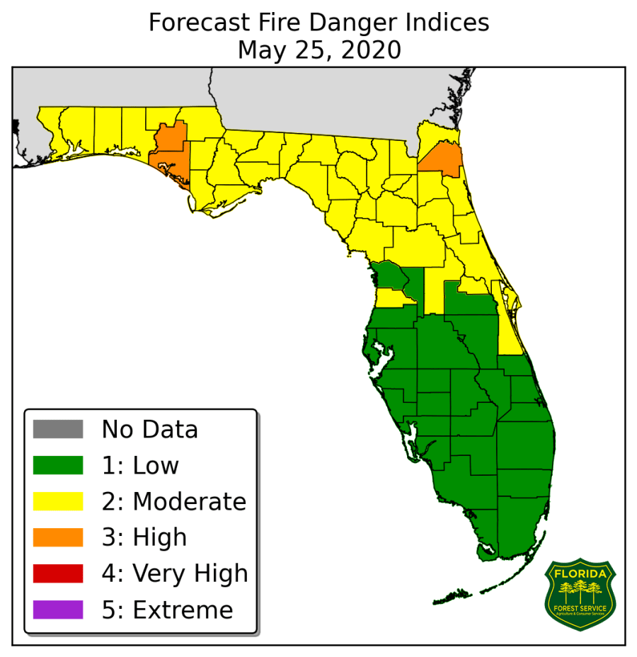
The Fire Danger Index map is a quick way for Florida residents to check the risk in their county.

This map is “a continuous reference scale for estimating the potential for a fire to start and require suppression action on any given day,” according to the Florida Fire Service.
“The first thing that we’ve got to look at is how many days since significant rainfall, so what is significant rainfall to us? That’s about a quarter of an inch of rain,” said Chase.
Chase says that the Fire Danger Index is a quick reference guide to determine if you should burn or not.
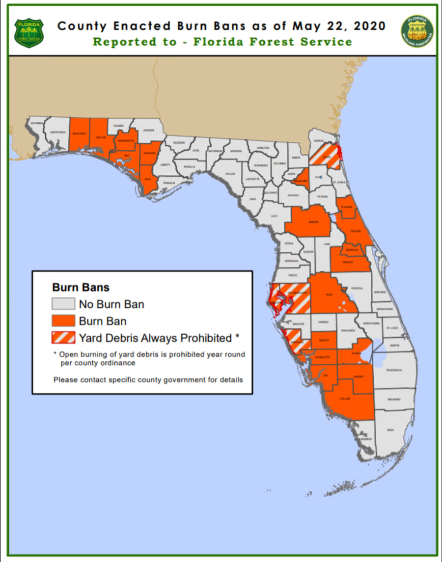
It’s also important to remember that Duval County has a year-round burn ban, and right now, Bradford County also has a burn ban.

Both human elements and lightning are the main contributors to wildfires in the state of Florida.
But the question remains: Will this week’s rainfall positively impact our fire danger risk?
“If we continue to see this trend with the rain, we’re going to see that the drought dropped a little bit, but we’re still on a high drought threat right now," said Chase.


