FLAGLER COUNTY, Fla. – Hurricane season begins in two days and now is the time to prepare.
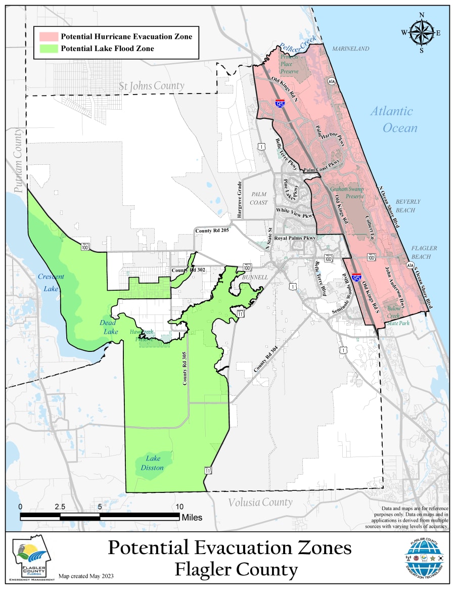
Flagler County Emergency Management is rolling out new measures to help keep residents safe. One is a new evacuation zone map.
Jonathan Lord, the county’s Emergency Management Director, said the map was created using new data analyzed by their Geographic Information Systems team.
It’s also broken down into two zones, an eastern potential hurricane evacuation Zone, which includes areas closer to the ocean and a western potential lake flood zone.

Lord also said the county plans to roll out a new way of letting residents know of evacuation orders.
Last year’s evacuation orders included neighborhoods but also labeled them as things like Zone A or Zone B.
To help cut down on confusion they will eliminate using zone names and just use neighborhood names and descriptions.
“We will order evacuations by neighborhood,” Lord said. “So, we will name a neighborhood being evacuated as a storm approaches. We may do it twice. We may ask a larger area to be prepared and if the forecast improves and we get better information, 12 hours later we’ll adjust those zones.”
It’s a new method, Flagler County resident Dawn Dixon and her husband, who moved here from Maryland months ago, said would be helpful.
“I think that’s definitely important as we moved down here we had no idea if we were in one of those zones or not without checking the map,” Dixon said. “So, that would make it easier for people who are vacationing, not sure, not familiar with the area to hear the community name versus the zone.”
Also during the media availability Lord said they are planning to provide residents with more clarity on times to avoid traveling over bridges, instead of just saying the bridge is closed.
Lord noted this was being done after more feedback from residents who said the verbiage of “closed” when used in the same sentence as “bridge” would sometimes confuse them.


