JACKSONVILLE, Fla. – Barry is now a tropical depression with winds of 35 mph over northern Louisiana.
INTERACTIVE MAP: Tracking the Tropics
Recommended Videos
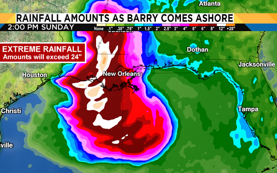
The slow movement of Barry will result in more heavy rainfall and flood threat along the central Gulf Coast, across portions of the Lower Mississippi Valley and north into the Tennessee Valley through the weekend into early next week. Flash flooding and river flooding will become increasingly likely, some of which may be life-threatening.

Tropical-storm-force winds are hard to find and most locations as of 5 pm Saturday are gusting below 40 mph across southern Louisiana.
The biggest threat is not from the winds but from extreme rainfall that could exceed 24 inches over areas just to the right side of the ultimate track of the storm. This could produce life-threatening flooding in these areas, and areas just south of the heaviest rainfall.


