JACKSONVILLE, Fla. – We all seem to hold our breath when the next round of forecast models are released. They come out and the office arguments begin!
Battle of the global forecast models!
Recommended Videos
You will hear me often cite the two most well-known global forecast models, the GFS and Euro. They both represent some of the most sophisticated and complex forecast models that mankind has ever created.
They are made with as many as 64 horizontal layers, within a high-density mesh of grid points separated out by 18 miles, across the entire planet. Iterations on atmospheric conditions are then rendered out through time, for up to 16 days, and this is done on some of the fastest operational computers in the world.
GFS vs Euro: Their important differences?
The Euro has a more sophisticated ability to incorporate more real-time and experimental data, the GFS operates at a higher resolution and carries this out further in time. These two different directions of finding a solution lead each model to have its own set of quirkiness. These are known as systematic errors.
Systematic errors
These are errors that are systemic to a model. An example would be if a particular model always does something in particular, say, it always moves tropical systems too fast, or too slow. This is considered to be a systematic error.
Forecasters at the National Hurricane Center (NHC) and National Centers for Environmental Prediction (NCEP) routinely study the output of these models (and many other models) to determine each model's individual biases. Knowing these can go a long way to helping make a better forecast.
Reminder: Models don't make forecasts, forecasters make forecasts. Model output is merely guidance to the forecaster.
You may have experienced these errors on your mobile weather app. Many weather apps are created with no filtering from forecasters. You are getting the raw numbers on your phone. Often times they can be very wrong.
We here at Channel 4 (The Weather Authority app) often correct these numbers, after all, we are forecasters here at Channel 4 and when we see a glaring fail, we update (correct) it. Those other weather apps, not, so much.
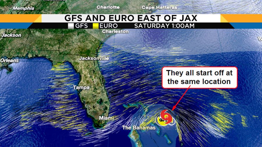
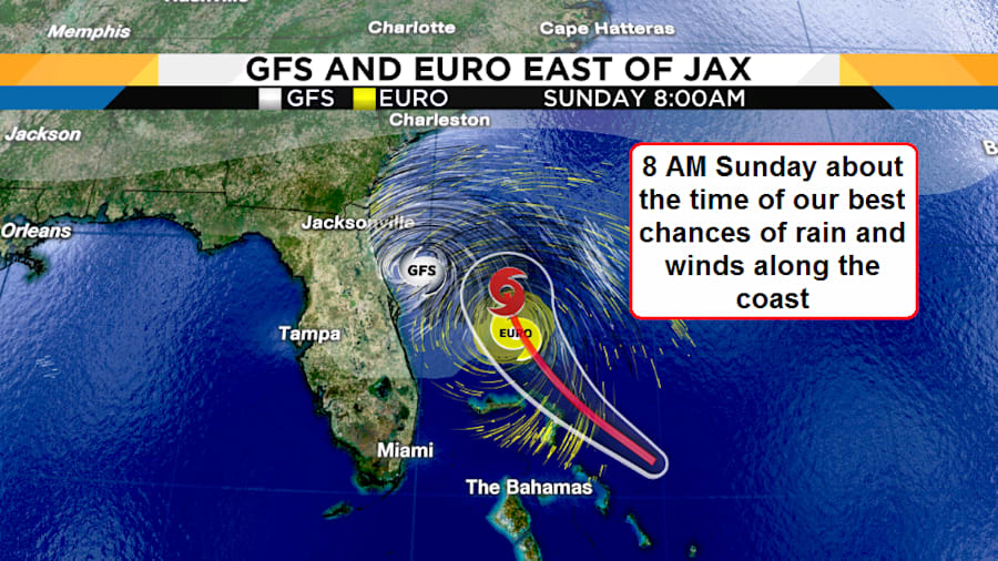
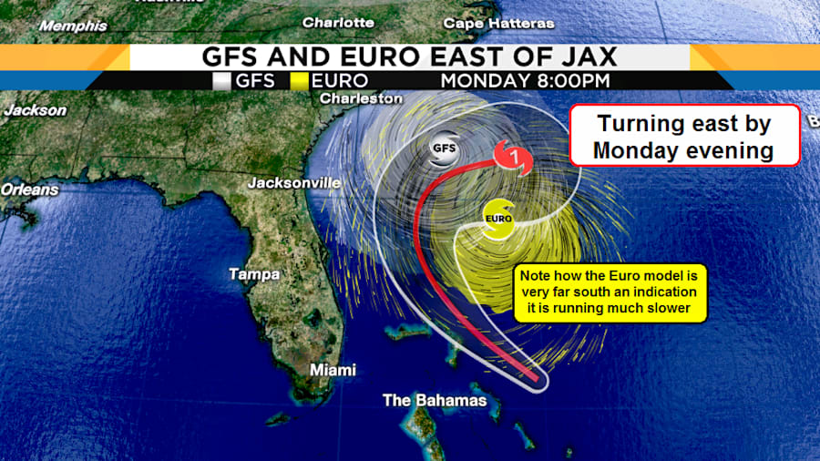
The Euro and the GFS have been saying two different stories. The GFS has been suggesting a weak and broad low pressure would slowly develop into a tropical depression, then later a tropical storm just as it was about to make landfall along the Eastern Florida Coastline.
The Euro has been slower, developing a tropical storm faster and later into a hurricane that would stay well offshore Florida.
Their individual tendencies are basically saying either weak-fast (GFS), or slow-stronger (Euro).
Meanwhile, back at the National Hurricane Center (NHC), they are currently splitting the differences between the two models, nearly perfectly.
This is not always the case.
There are many other global forecast models at the National Hurricane Center's disposal. Global models such as CMC/GEM (Canadian), JMA (Japanese), ICON (German), UKM (United Kingdom), ACCESS-G (Australian), ARPEGE (French) and of course, the Florida State Superensemble model.
Additionally, there are hurricane specific models such as the HMON and HWRF. These two models are basically used for intensity forecasting but can have some use for track forecasting.
Anyhow, back to our current situation, as seen with the pics below, the National Hurricane Center is basically running faster and splitting the difference between the GFS and Euro.
But wait!
Is the Euro again telling us something that we should be paying attention to?
With each recent successive run of the Euro, the Euro is slower than its model run before, when I have seen this systematic error in the past, the Euro is really saying...
Watch out! This storm is about to stall!
Plus, here is a huge hurricane forecasting tip:
All the models want to track Humberto eastward, this is not uncommon at 40° North latitude, but is actually rare at or below 30° North latitude. This is especially rare in mid-September.
Stay tuned, Humberto may have other plans than what we are seeing from the current forecast models.


