JACKSONVILLE, Fla. – This hurricane season is on pace to become the second most active Atlantic hurricane season on record, if the latest seasonal predictions from federal forecasters come true.
Hurricane specialists and researchers at the National Hurricane Center and their parent organization, NOAA, announced its midseason updated forecast Thursday.
Recommended Videos
The season has already been a record-breaker with nine named storms and the updated forecast includes those storms and up to 16 more.
NOAA initially stated a 60% in May of an active season but has been increased those odds to 85%. Now NOAA is predicting up to 25 named storms with today’s midseason update.
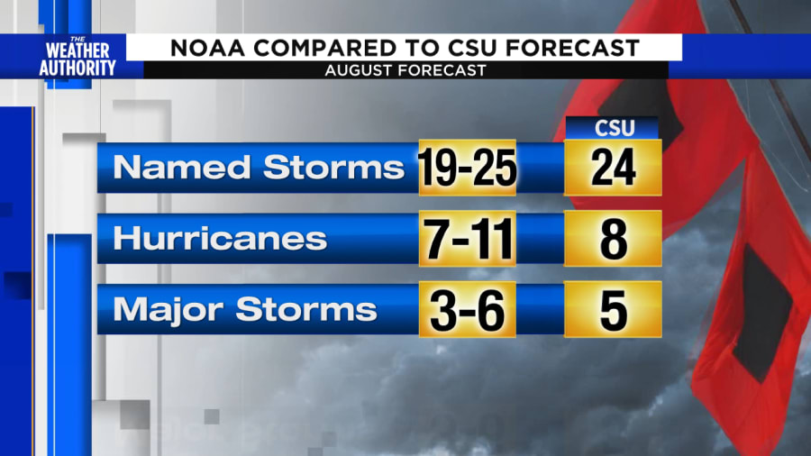
The total number of named storms forecasted has increased between 19 to 25, with seven to 11 hurricanes and three to six major hurricanes.
On Wednesday, Colorado State University also bumped up its seasonal predictions, expecting 24 named storms, 12 hurricanes with five becoming major storms with winds over 115 mph.
During the infamous 2005 hurricane season, NOAA predicted in its August outlook another extremely active season, with an expected total of 18-21 tropical storms and nine-11 hurricanes.
That record-shattering season which brought Hurricanes Katrina and Wilma resulted in 28 named storms. It was the first time a backup list of names using the Greek alphabet had to be used after running out of names on the list.

What is causing the expected uptick in storms?
Much like 2005, warm sea surface temperatures, the African monsoon, low shear, and weak trade winds are all expected to lead to above normal activity.
Strong winds called vertical wind shear tilt storms in a way where thunderstorms can’t focus around a circulation point. Storms need light winds aloft to develop and this has been the case throughout July. The expectation for continued low wind shear ahead makes the case for more frequent storms.
In fact, the last time winds aloft were this calm over the main hurricane development region of the Atlantic was in 2005 during the most active season on record according to the lead hurricane forecaster at Colorado State University, Philip Klotzbach.
Another reason for the extremely active Atlantic hurricane seasonal forecast is due to the abundant number of tropical waves rolling off West Africa. The monsoon pattern is churning out robust easterly waves more than usual. Combined with the favorable upper winds, they have a good chance for developing into tropical systems as they track across the open Atlantic.
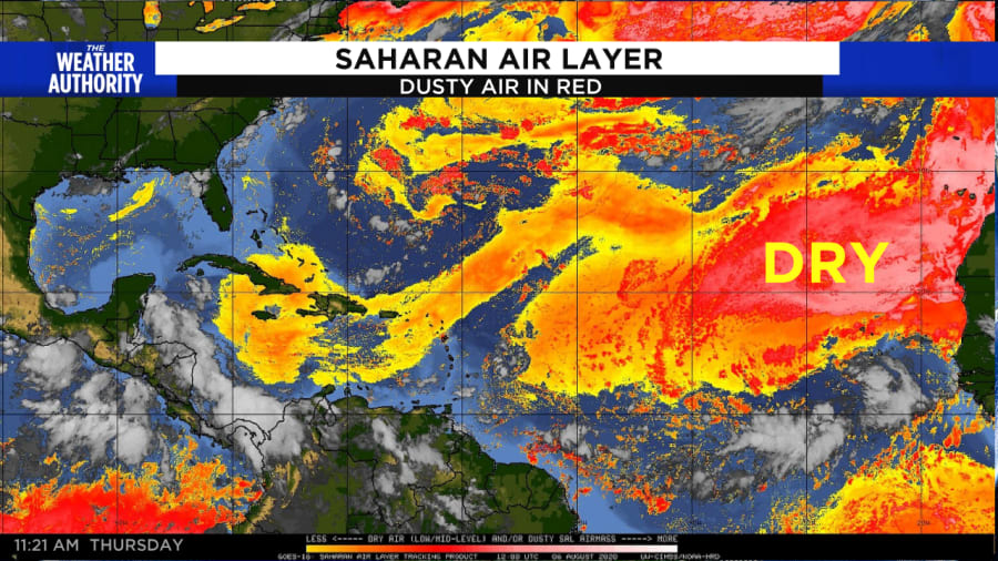
Why so quiet now? It looks like for at least another week tropical activity will be suppressed before the potential flurry of storms fire up late in August and during the September climatological hurricane season peak.
Dry air is covering the main development region suppressing activity for the next several days.

But even more telling will be how the Madden-Julian Oscillation, or MJO, plays a role at the end of the month.
The Atlantic is currently in the suppressed phase of the MJO, limiting storms in the Atlantic as air sinks across large stretches of an ocean basin. Once this pattern reverses it could lead to a multi-week period of conditions enhancing tropical storms in the Atlantic.


