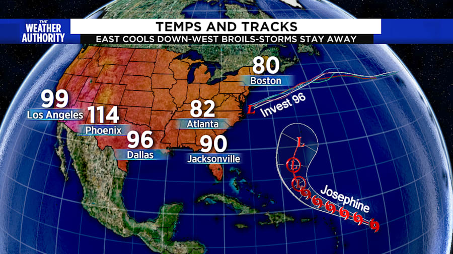
A weather pattern stretching across the country is broiling the West Coast with intense heat while offering us hurricane protection for a couple of weeks.
Sorry for the 100° temperatures headed your way next week California, but the downstream effects from your heatwave should keep any developing hurricanes out to sea for Floridians and offer up cooler temperatures along the East Coast of the United States.
Recommended Videos
Our hurricane protection comes as an East Coast trough of upper winds blows from the Southwest. A developing low called Invest 96 showcases this deflection. It is tracking away from North Carolina and those same winds should weaken Tropical Storm Josephine over the weekend.
Hooray! But while the tropical storms stay away, this isn’t to say we will dry out. Rather, afternoon storms over Jacksonville will be enhanced with even more frequent and heavier rain by the middle of next week.
Unfortunately, we don’t see much of a break in the heat, but the “cool down” will keep places from Atlanta to Boston in the 80s.

Meanwhile California, Texas and Arizona will cook with temperatures over 100° under a hot bubble of high pressure locked in over the Southwest.
As long as that feature stays, the blocking downstream flow will help keep tropical cyclones from targeting the Sunshine State.
Unfortunately, these protections don’t last long and could relax by the most-threatening hurricane month of September.


