JACKSONVILLE, Fla. – Floridians need to be very watchful as Tropical Depression 13 -- likely a tropical storm on Friday -- could impact the state of Florida in just five days. There are growing indications that this system will become a hurricane and possibly a major hurricane by early next week.
A center of circulation developed overnight Wednesday and by 11 p.m. Thursday, the center of the system was 445 miles east of the Northern Leeward Islands and it was moving west-northwest at 22 mph. It had sustained winds of 35 mph.
Recommended Videos
A tropical storm watch is out for Puerto Rico, Vieques and Culebra, the U.S. Virgin Islands and the British Virgin Islands.
The National Hurricane Center said at 11 p.m. that heavy rains from the depression are expected over the Northern Leeward Islands on Friday.
RELATED STORIES: Tropical Depression 14 forms, to head into the Gulf | Wind shear fades over the Main Development Region of the tropics - A bad omen? | Mid-August starts a critical shift in Jacksonville’s weather pattern
This is the 13th tropical depression for this season, a record for the earliest 13th tropical depression of any season (169 years). This system will likely grow slowly the next two days and then possibly interact with Puerto Rico and possibly Hispaniola, if it does, the National Hurricane Center believes it would weaken and possibly remain weak.
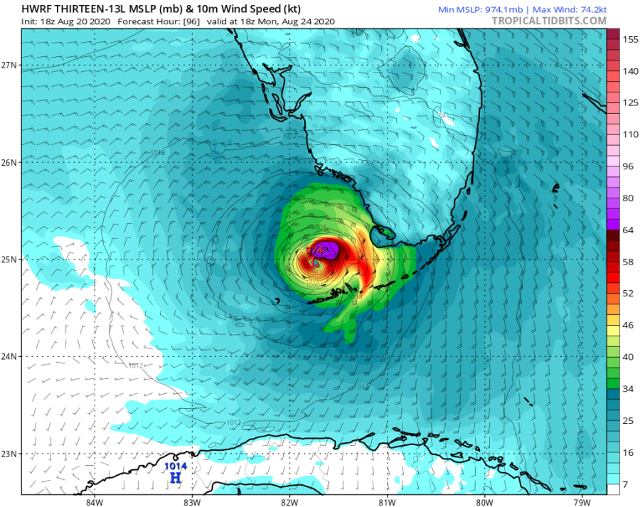
All models maintain a marginal tropical storm through Saturday morning, but after that, models that focus just on the hurricane (and its structure) really blow up TD 13. Time will tell as the next 48 hours will be a challenge for TD 13 as the system is moving too fast to develop. It is when it slows on Saturday, that it may find its ability to “catch its breath” and develop quickly thereafter. The image below, taken from TropicalTidbits.com shows one of the hurricane models (actually both the HWRF and HMON do) suggests a strong Category 2 hurricane moving into the Upper Keys by Monday afternoon.
ONLINE TOOLS: Interactive tracking map | Plan and Prepare
A second system being watched by the hurricane center became Tropical Depression 14 and is also expected to become a tropical storm by the end of the day.


