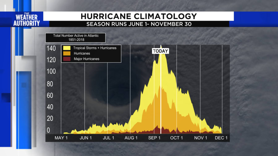
JACKSONVILLE, Fla. – Sept. 10 marks the peak of hurricane season, statistically. By now, everything is in full swing with warm water, more humid air in the tropics and a general pattern that favors long tracking strong hurricanes across the central Atlantic.
Satellite records since 1966 show, on average, there’s at least one storm present in the Atlantic basin on Sept. 10 at least 50% of the time.
This year, Tropical Storms Paulette and Rene are out in the Atlantic -- both expected to remain well out to sea -- and the National Hurricane Center is watching four other systems with various chances of becoming storms.

Hurricane Dora’s 1964 landfall in St. Augustine is a reminder how the odds for damage increase this time of year. It developed from a Cabo Verde tropical wave near the coast of Senegal and grew in strength north of the Greater Antilles.
FROM THE VAULT: Dora: Direct Hit
This year two tropical storms Paulette and Rene‘s serve as an example of classic Cabo Verde systems that develop in the far eastern Atlantic.
Cabo Verde hurricanes are often the most dangerous accounting for more than 75% of all major hurricanes developing in early to mid-September.
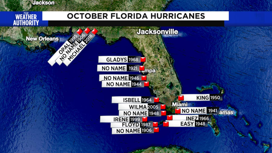
But while it is usually the busiest time for storms overall, Floridians are most likely to see a landfalling hurricane in October. Since 1851, 10 of the 17 major hurricanes to strike the U.S. mainland have occurred in Florida in the month of October.

What makes Florida so prone to hurricane strikes in October?
Storms tend to form closer to the western Caribbean Sea, eastern Gulf of Mexico and east of Florida in the Atlantic Ocean as the season winds down and shifts away from September storms that develop closer to Africa.
October cold fronts sweeping into the Gulf often steer storms into Florida as was the case with Hurricane Wilma when the Category 3 made landfall near Cape Romano with winds of 120 mph.
Many of these late-season storms can be strong like in 2016 when Hurricane Matthew passed just east of Jacksonville and Hurricane Sandy which was the third costliest hurricane ever.
Residents in Mexico Beach are still recovering from Hurricane Michael in 2018 (eighth most costly), and 2005’s Hurricane Wilma (ninth most costly).


