Hurricane Delta makes it’s 2nd landfall in Louisiana in a season that has seen back-to-back attacks on the Pelican State.
Louisiana’s bad luck started with Cristobal becoming the second-earliest tropical cyclone to make landfall in Louisiana.
Recommended Videos
Then came Hurricane Marco -- the first of two tropical cyclones to threaten the state within a three-day period. The second was Category 4 Hurricane Laura, the strongest hurricane on record to make landfall in Louisiana since a hurricane in 1856 -- before storms were given names.
Tropical Storm Beta was an omen for more trouble ahead.
It struck Texas first on Sept. 22 but moved on to soak Louisiana and now the National Hurricane Center is forecasting Tropical Storm Delta to make a direct hit in bayou country on Friday which is forecast to bring at least 10 inches of rain.
The active trend is not surprising for the northern Gulf has always been a hot spot for hurricanes.
The very first hurricane reference in the New World struck Spanish conquistador Panfilo de Narvaez near the mouth of the Mississippi river in 1527, approximately where Delta is expected to strike this week.
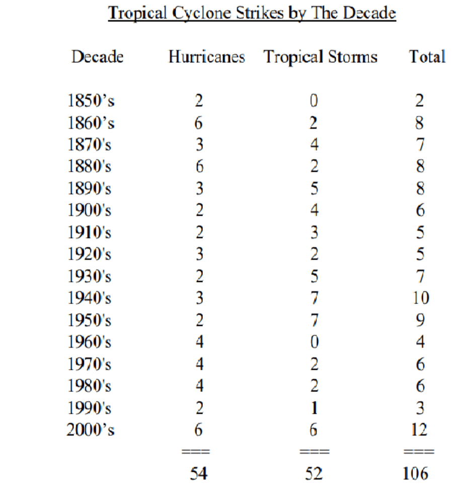
The list of storms is long averaging two tropical storm strikes in the state every 3 years since 1851.

Why do so many storms target the state?
The easterly winds typically blowing across Jacksonville in the summer flow out of the Azores/Bermuda high-pressure system which also steers many hurricanes into the Gulf.
In June and October, storms are more likely to move up the Gulf from the south and southwest.
As we are seeing play out with Tropical Storm Delta, cold fronts invade Louisiana and quickly pick up any low-pressure system lurking in the Gulf.
Unfortunately, these climatological conditions are unique to the Pelican State and are far outside the range for attracting hurricanes to Northeast Florida.


