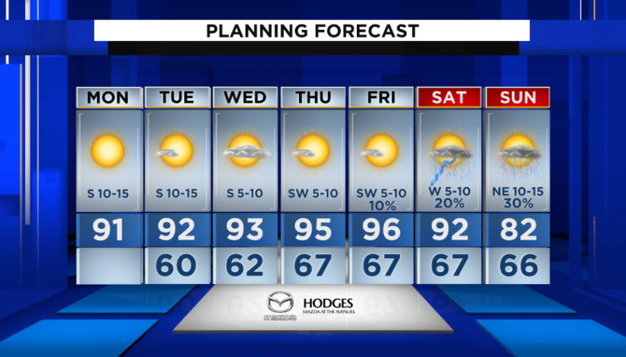
JACKSONVILLE, Fla. – Monday marks the first day of a weeklong heat wave that will culminate in near 100° inland temperatures on Friday.
This is the first time this year we could get six days in a row of 90-degree or higher heat along with the hottest conditions of the year as temps rise above 95 degrees on Thursday and Friday.
Recommended Videos
We had a nearly three-week pause from 90-degree temperatures, but the heat returns Monday afternoon.
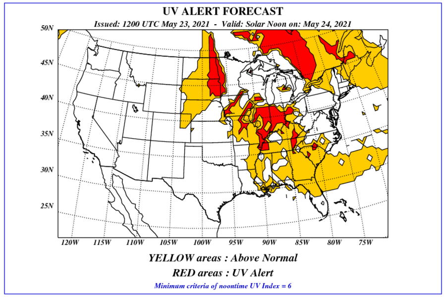
The lack of moisture in the air is resulting in sunny skies and an extra dose of UV radiation. The UV Index is 11, higher than average in Jacksonville, taking less than 10 minutes for fair-skinned people to burn.
The graphic below shows we are seeing above normal UV conditions (yellow). To make matters worse, the temperatures are expected to climb.
Highs Monday will be in the 90s from 1-6 p.m. across inland locations west of I-95 and it gets hotter Thursday and Friday in the mid to upper 90s.
An afternoon sea breeze holds coastal locations to the upper 80s.
Evening temperature will be comfortable without the humidity as overnight lows dip into the 60s.
The heat starts breaking down Saturday with cooler mid 80s by Sunday.