Determining when a hurricane season will be quiet or active depends on several environmental factors that aid seasonal hurricane forecasters months ahead of the first storm.
Colorado State University (CSU) has the longest continuous operational forecast for the North Atlantic basin since 1984 and pioneered the prediction technique.
Recommended Videos
In the early days, Dr. Bill Gray’s original forecasts were based on statistical relationships between climate phenomena such as El Niño-Southern Oscillation (ENSO) and TCs.
Now many of the forecast groups, including NOAA, combine past statistical storm characteristics with dynamical climate models to make predictions.
Decades of hurricane observations have revealed why some years are more active than others.
Anticipating future activity is predicated on dynamical model predictions of El Niño-Southern Oscillation (ENSO) and North Atlantic SST and sea level pressure (SLP) patterns.
Forecasters anticipate a bad season if these key factors are present or expected:
- La Niña in the Pacific is strong. When this happens, cold Pacific equatorial water temperatures alters global upper wind patterns that can reduce shear making it easier for storm development.
- Warmer than average Atlantic water temperature provides fuel to power hurricanes.
- Weak high pressure in the north Atlantic slows the rate of trade winds blowing westward across the tropical Atlantic and Caribbean Sea. This favors development by reducing shearing winds and encourages the counterclockwise motion of storm clusters that seed future tropical cyclones. Lower wind speed further warms the ocean because dosen’t get churned up as much.
Remember, don’t read too much into the seasonal outlooks since they don’t predict when or where a hurricane will track.
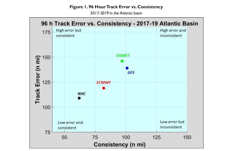
Predicting the track movement of storms is only possible up to about a week with some accuracy. The good news is once a system develops NOAAs forecast has improved over the years and still beats the top three hurricane forecast models.


