JACKSONVILLE, Fla. – Tropical Storm Elsa weakened slightly as it traveled over Cuba. Now we enter the “hope Elsa remains well behaved” zone.
There is always a “moment” where a tropical cyclone can make a dramatic and unexpected shift. Elsa, is now off the coast of Cuba and will have about 18-24 hours of running over the warm Gulf of Mexico waters reintensify.
Recommended Videos
Note: had this been later in the season, say mid-August through mid-October, I would almost expect some level of RI. RI is rapid intensification. This doesn’t seem likely due to the calendar, only modestly positive for development upper-level conditions and so-so warm water temperatures.
Elsa, up to now, has been a very well-behaved cyclone. Yes, Elsa did become a hurricane while traveling nearly 30 mph (an unconfirmed record breaker, for being the fastest moving hurricane in the Caribbean Sea). Then again, Elsa never powered up after slowing down. At least not yet.
Tropical storms can ‘miss’ a lot of areas yet leave some neighborhoods seriously washed out. Elsa looks to have this kind of hit-n-miss impact on Wednesday.
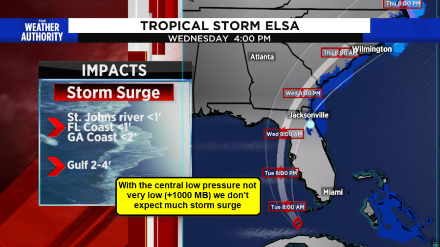
Elsa, has also followed, extremely closely, the script as laid out by the National Hurricane Center. Their forecast has been for a landfall in the NE Gulf of Mexico between Jacksonville and Tallahassee. This seems highly probable as nearly every forecast model is showing this outcome.
The National Hurricane Center continues forecasting a track just west of Lake City sometime Wednesday, around the lunch hour.
TRACKING THE TROPICS: Interactive map | County-by-county forecast | Mark Collins answers your questions
My experience with these weaker systems (tropical storms) has been, there’s always one or two neighborhoods that will get slammed by isolated extreme rainbands with winds and extreme rains.
Everyone else just “yawns” as local impacts tend not to be widespread.
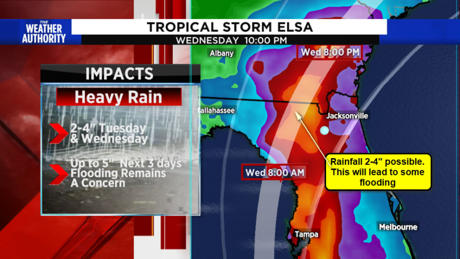
- 2-5″ of rain will still be possible. Most areas will receive about 1-2″. For perspective, this is what we have been experiencing the past month. This will lead to minor to moderate impacts on backyard flooding. Black Creek could flood if rains exceed 4″ in the head waters (Western Clay County).
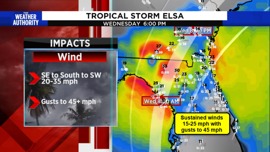
- Winds may still reach gusts to 45 mph. There will be squalls of rain starting sunrise Wednesday morning. brief, yet intense there will be a few people who may experience winds that could send trash cans rolling down the street, over turn a few BBQ’s, maybe knock over some plants on a balcony. All things that should be tucked away from being blown around.
- Power outages tend to be isolated with these type of moderate winds. Not widespread.
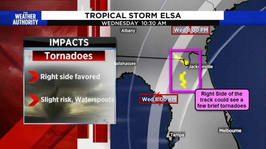
- Only a slight threat of tornadoes/coastal waterspouts. Tornadoes would typically be an issue, but the passage through our area will be during the very early morning hours. This will reduce the threat.


