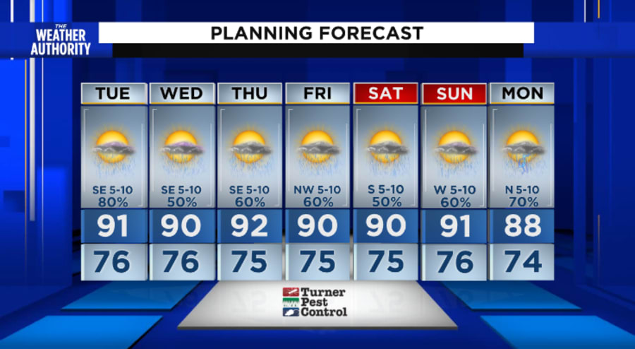
JACKSONVILLE, Fla. – Forecast models are not in great agreement in terms of our weather. A number of them want to dry us out rather quickly. I suggest we need to be alert to multiple rounds of rain. On the face of it, the amounts will not be all that, another 1-3″ between tonight into Tuesday evening. The trouble is we are super saturated and even moderate rainfall at this point will cause some localized flooding.
Fred continues to move ashore and weaken here’s more on the tropics.
Recommended Videos
Tonight, most evening rains will fade before 8pm. With partly cloudy to cloudy skies, we could have a decent sunset for a few folks. Sunset is at 8:10 p.m. Evening temperatures will be cool for August. Mainly in the 70s overnight into tomorrow morning. Winds will be southeasterly up to 15 mph.
Tomorrow (Tuesday) there will be sunrise heavy rains possible, mainly out west of Jacksonville. Watch Richard in the morning to get a feel on where the rains will be shifting throughout the day. There will be some sunshine and afternoon highs will approach 90° as southwesterly winds will be around 15 mph. Rain chances will be about 70%, with up to 2″ of rain in some heavier downpours.
The tropical rains back-off a little bit into the end of the work week. Afternoon highs will be near 90°. These storms will be mainly during the afternoon and evening hours and rainfall amounts will be another 1-2″. In other words, there will be more opportunity to heavy rains.
Keep your umbrella with you.


