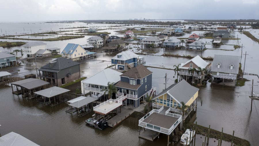
This past year has been a year for climate extremes. More frequent and intense wildfires in the West and dangerous flash flooding across the East.
The big question: Why are we seeing this change? One answer is the ever changing climate of our planet.
Recommended Videos
When it comes to wildfires, heat, dryness and wind are the main components that affect fire behavior.
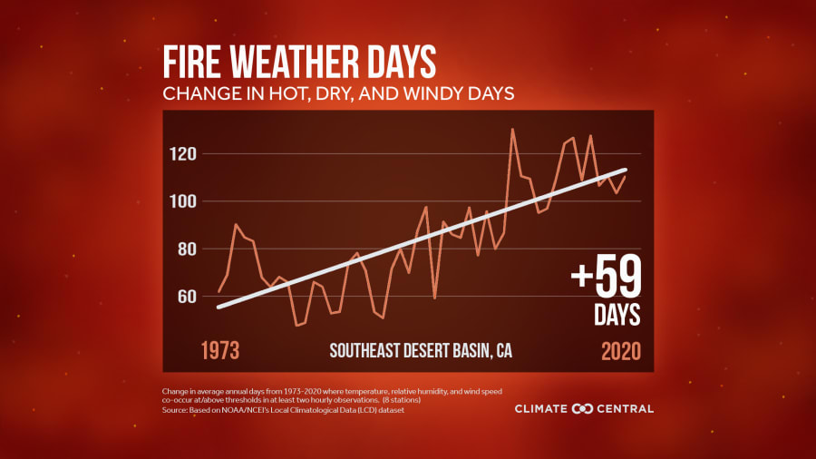
A new analysis from Climate Central shows the frequency of fire weather days and how they’re increasing across most of the American West, driven by dryness and heat.
Across the Southeast Desert Basin in California, the fire weather days have increased by roughly 59 days since 1973.

Looking at Fresno, California, over the past 50 years, they’ve increased their number of 100-degree streaks by roughly five days.
There are currently 17 wildfires burning in the state of California with 1,926,123 acres burned.
Moving back East, the rising air temperature and water temperature can impact the frequency of heavy rainfall.
Warmer oceans increase the amount of water that evaporates into the air. When this moist air moves over land, it develops into a storm system and produces more intense precipitation.
These warmer waters lead to more intense tropical systems.
Currently, in the 2021 Hurricane Season, we are under a La Nina watch. A La Nina will weaken the amount of wind shear in the tropics allowing storms to thrive. This coupled with warmer waters can lead to the development of intense tropical systems.
ECMWF is forecasting a very strong trade wind surge in the central Pacific over the next two weeks. These anomalously strong low-level winds favor a transition to #LaNina for the latter part of the Atlantic #hurricane season. pic.twitter.com/OtEg8gcJ6Q
— Philip Klotzbach (@philklotzbach) August 31, 2021
One example of this would be Hurricane Ida.
Hurricane Ida rapidly intensified over the Gulf of Mexico due to some very warm waters and made landfall as a strong Category 4 hurricane with max winds of 150 mph.
After Ida caused catastrophic damage along the Louisiana, Mississippi and Alabama coast, the storm moved inland.

As a depression and even a remnant low, Ida caused life-threatening flooding due to heavy rainfall across the southeast and northeast region.
New York broke a new record for the most amount of rainfall in one hour at 3.15 inches on Wednesday. The previous record was 1.94 inches just a few weeks earlier on Aug. 22.
A preliminary report shows that Central Park received roughly 7.19 inches and Newark received 8.44 inches of rainfall from Ida.
Preliminary Ida Storm Totals & Stats
— NWS New York NY (@NWSNewYorkNY) September 2, 2021
💧Central Park: 7.19"
💧JFK: 2.77"
💧LaGuardia: 6.89"
💧Islip: 2.63"
💧Newark: 8.44"
💧Bridgeport, CT: 5.94"
Wednesday was the wettest day on record for Newark and LaGuardia, 3rd wettest at Bridgeport, and 5th wettest at Central Park.
The stunned U.S. East Coast is now facing a rising death toll, after the remnants of Ida walloped the region, drowning more than 40 people in their homes and cars.


