JACKSONVILLE, Fla. – If history is a guide, the development date (the day on which a storm is named) for the final tropical cyclone) will be Thursday, Nov. 4, 2021. Historically, this storm will most likely develop in the Central or Eastern Atlantic Ocean. It most likely will be the leftover of a non-tropical cyclone that sat over the super warm water of the Atlantic Ocean for too long and transitioned from a non-tropical cyclone to a tropical cyclone.
Most importantly, the storm will not impact anything except some of the shipping lanes.
Recommended Videos
Fingers crossed this plays out.
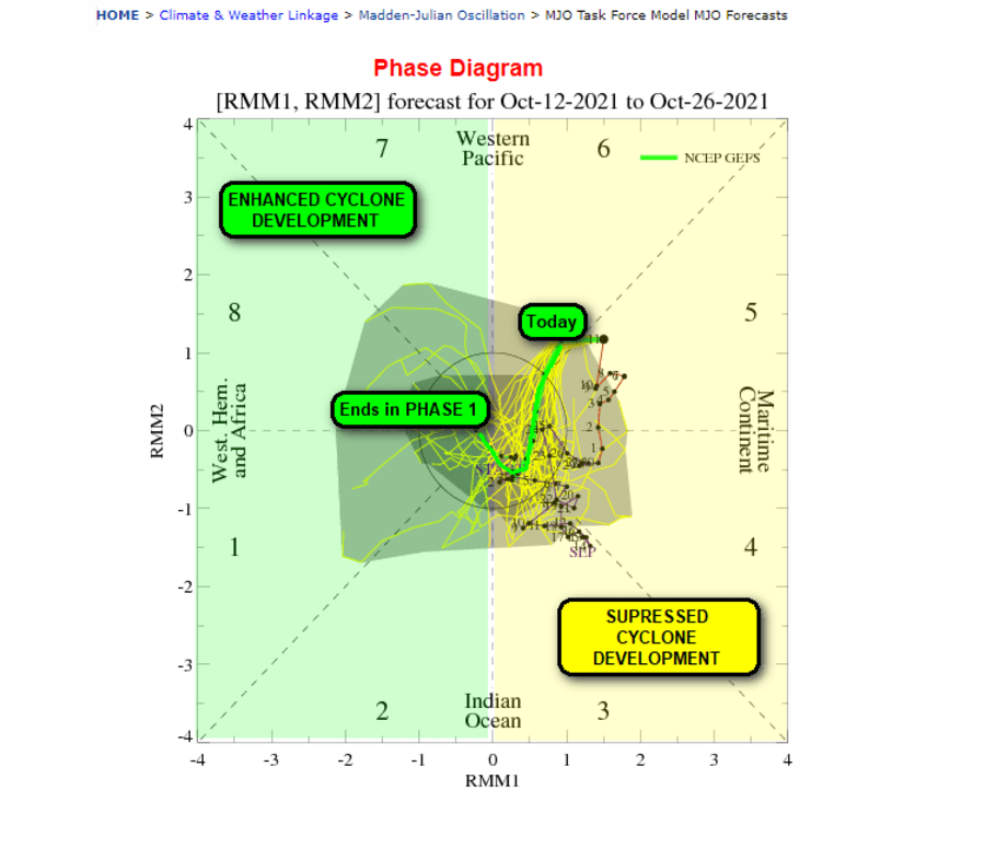
On the other hand, the MJO (see prior newsletters) is, unfortunately, making a late-season push to a much more conducive phase. This suggests there will be one final “blowout” storm of the 2021 hurricane season.
The good news for Jacksonville? The worst case is that this cyclone would pass from the Caribbean into the Gulf and then cross Florida. This track would likely be somewhat south of Jacksonville and impact would be limited.

Then again, these are not ordinary times, as this cyclone (should it actually develop) could do something extreme, and when it comes to weather extremes, who knows where the limits are on that these days.
More crazy weather statistics: The average last tropical cyclone development day is now one week later than it was at the turn of the century. In 2000, the average final tropical cyclone development date was Oct. 27. Now it is one whole week later, Nov. 4.
Back to the MJO forecast, the GFS (Global Forecast System, aka the American Model) had a number of tweaks made to it through 2020 and 2021 and the results have been very impressive, showing to be the most accurate of the global models.
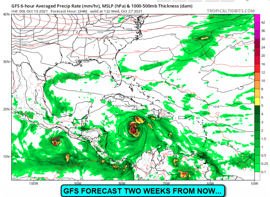
Global models have longer range forecasting capabilities beyond the Holy Grail of five days out. These models show skill up to two (or more) weeks out. And for at least the more recent forecast model run, as this morning, the GFS is not just shifting the MJO into Phase 1,2 (highly conducive for tropical cyclone development) but actually does develop a tropical cyclone later this month.
Call me skeptical, for now, as this is just one model run (GFS model runs take place four times daily), maybe if it is still forecasting this possibility in five days, we may have something to really talk about.
It would seem fitting for one last blowout cyclone after having a record-smashing 50 tropical cyclones in just two years!

Fall treat in the night sky 🔭
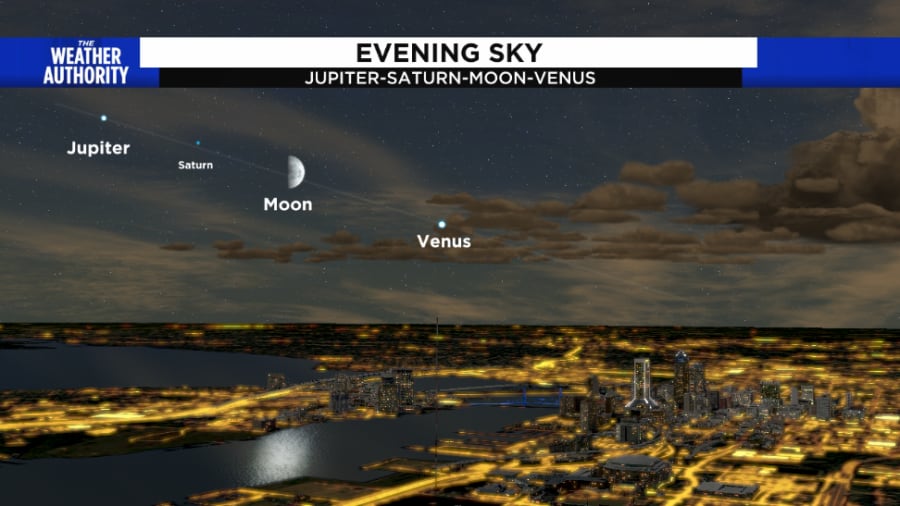
Shorter-term, our evening skies will put on a show as the Ecliptic Plane is filled with planets and our moon.

This alignment will shift each night as the moon will rise later each day and appear to be shifting to the left. So, it will be closer to Saturn and then Jupiter by Saturday evening.
Gather your friends/family and have them take a peek at this alignment. It is actually fairly common, but not so much in Jacksonville, as oftentimes we have leftover thunderstorm clouds which block our view.
Larger binoculars will allow you to see the moons of Jupiter and a small telescope should be enough to make out the rings of Saturn, although just barely.
Other recent weather articles from The Weather Authority 📰
Pin of the Week 📷

Ever wanted to see your photo featured in a TV forecast or one of our newsletters? Login to your Insider profile and upload your pics to SnapJAX.
Enhance your Insider experience 🌟


