JACKSONVILLE, Fla. – Last Thursday, we had a Weather Authority Alert Day (WAAD) and “boom” it was a wild day. Two rounds of bad weather merged into one messy day. Rainfall was widespread and there were a few severe thunderstorm warnings for gusty winds and very heavy downpours. Rainfall amounts were basically between 1-2″.
The following pics set the stage for this Friday.
Recommended Videos
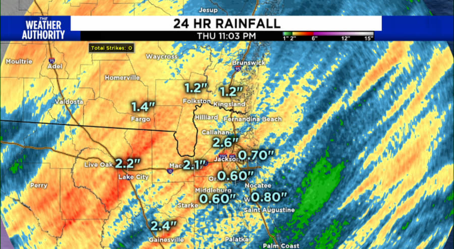
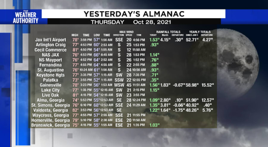
So... How does this play into this coming Friday?
Well, there is a building case for a significant nor’easter for our area starting this Thursday night into early Saturday.
Unlike the nor’easter that slammed Massachusetts and Rhode Island last week, winds along the coast reached hurricane values of over 73 mph. Those winds ultimately downed power lines knocking out power to nearly 1,000,000 people. Interestingly, that area of nor’easter had a tropical “kicker” that swirled into the upper-level feature and ultimately this helped it become sub-tropical storm Wanda over the weekend.
Southeastern United States nor’easters are typically induced by high pressure, not low pressures, this Friday, it will be a combo.
WAAD this Friday
This will be the case this Friday, as the one-two combination of low pressure developing over Central Florida (south of Jacksonville) and a high pressure over the Carolinas will be more than enough to develop a moderate nor’easter for Southeast Georgia and Northern Florida.
| WHAT TO EXPECT | Beginning when? | Worst (timing) | Worst (condition) |
|---|---|---|---|
| Coastal Areas | |||
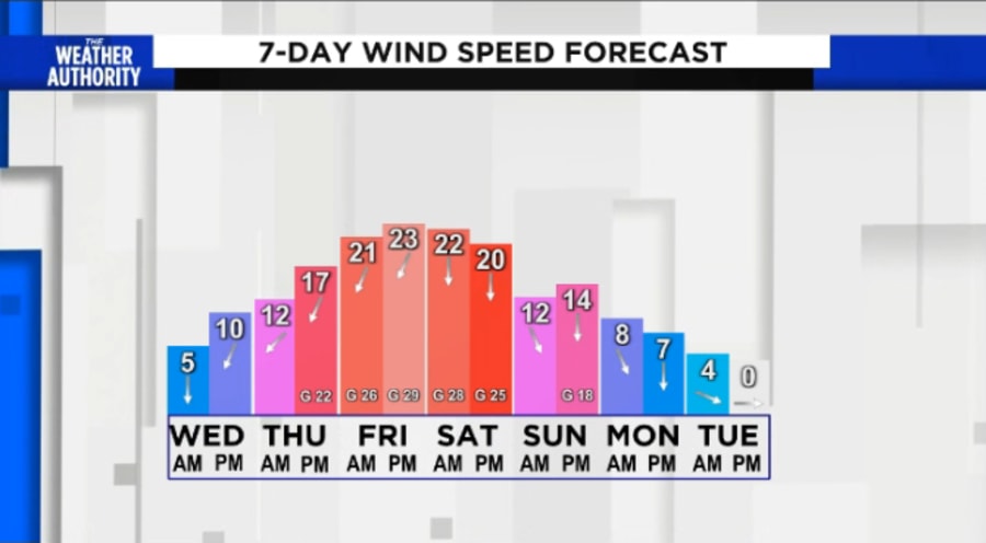
| Winds | Thursday night | Friday afternoon | Gale Warning?? Gusts to +40 mph offshore, beaches 35-40 mph) |
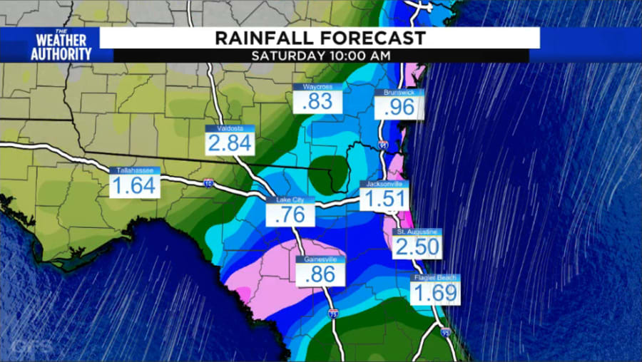
| Rainfall | Thursday evening | During the day Friday | Amounts up to 3″ generally 1-2″ |
| Coastal Flooding | Friday morning | At High Tides 9 AM Friday & 10 AM Saturday | Tides are at astronomical high tides but will be another 1-2′ higher |
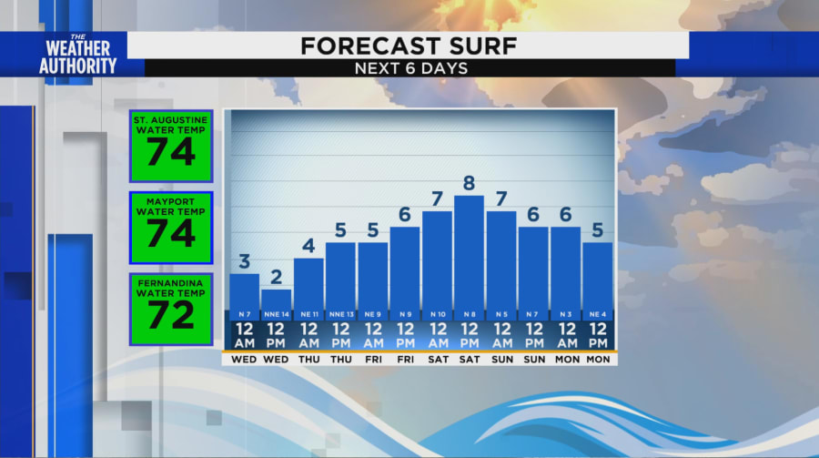
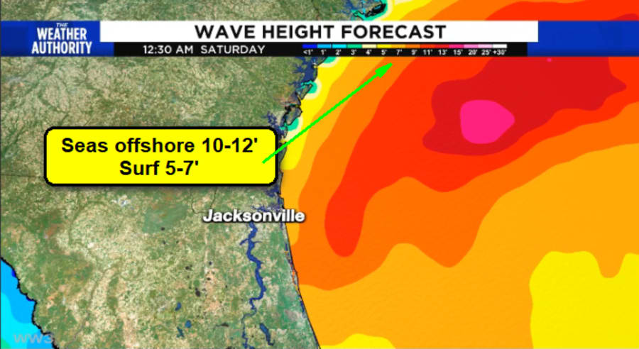
| Heavy Surf | Friday morning | Friday and Saturday | Surf 5-7+′ and slowly subsiding on Sunday |
| High Rip Current Risk | Friday morning | Friday and Saturday | Risk will be high slowly subsiding on Sunday |
| Inland Areas | |||
| Winds | Friday Morning | Friday afternoon/evening | Gusty winds to 25 mph |
| Rainfall | Friday | Friday afternoon | Amounts 1″ or less, especially west of Jacksonville |
| Chilly Daytime Temperatures | Friday | Friday & Saturday | Highs in the upper 50s and low 60s (don’t forget the wind!) |
Reading those details, it’s clear the worst of the weather will impact tidal areas of the beaches and intracoastal, plus it will be really nasty outside.
On a Friday too!
Nobody got time for that!
The Following graphics will be updated as we head into the nor’easter, stop back for updated details!
