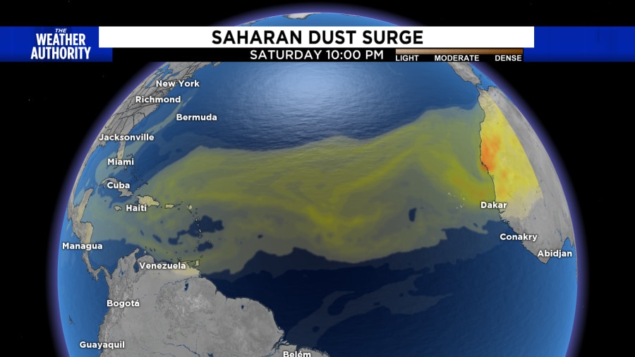
The tropics have been very quiet through the month of July, and that was partially due to an influx of Saharan dust traveling across the Atlantic. This is common every season, but when it happens, the dry dusty air associated with strong winds chokes off any sort of tropical development.
But the dry dusty air won’t last forever.

Looking back at previous seasons, it’s common to see a lull in activity for the months of June and July, but we’ve been very quiet thus far with only three named storms.
Chief Meteorologist John Gaughan goes into detail in his weekly newsletter on how he believes the season will pan out.
“Officially, we have had three named tropical storms and no hurricanes. Colin, the last named storm, would have never been named before 1965. Lasting only a few hours, Colin should have never been named. That means the ‘real’ count for this hurricane season is just two named storms. This is below normal for an “average” hurricane season.
“But remember, this is supposed to be no ordinary hurricane season — it is supposed to be an extreme season.
“Patterns suggest we’ll start to see an increase in storms by mid-August heading into September. Peak hurricane season is September 10th.
“I trust the seasonal hurricane forecasters. They help remove the “blindside” of being prepared against extremes. At this time, their seasonal numbers will likely be coming down into the 14-16 range with 7-10 hurricanes and 4-5 major hurricanes.
“Put me down for just nine more named storms, six hurricanes and three major. That will make this a relatively average season. But remember, it only takes ONE to make this season memorable. I see South Florida and the Carolinas — U.S. East Coast — most vulnerable. Although I am sure there will be at least one scary Gulf of Mexico storm, maybe in October? Just a hunch.”
We also need to factor in that La Nina conditions are favorable through the rest of the season.
What does this mean?
We’ll see warmer-than-average sea surface temperatures in the Atlantic Ocean and the Caribbean Sea, weaker tropical Atlantic trade winds and an enhanced west African monsoon. An enhanced west African monsoon supports stronger African easterly waves, which seed many of the strongest and longest-lived hurricanes during most seasons.
NOAA has the odds of La Nina remaining through July-September 2022 at 60% and only a 39% chance of it weakening down to neutral conditions during the period.
The 2022 NOAA hurricane forecast calls for 14 to 21 named storms (winds of 39 mph or higher), of which six to 10 could become hurricanes (winds of 74 mph or higher), including three to six major hurricanes (category 3, 4 or 5; with winds of 111 mph or higher). NOAA provides these ranges with a 70% confidence.
Dr. Phil Klotzbach and his Colorado State University team will update their seasonal forecast later this week on Thursday. We will have to wait and see if they lower the forecast numbers.


