All eyes remain on Hurricane Ian as it continues to track towards the Florida Gulf Coast in the coming days.
One concern for those stretching from the Keys to the Big Bend region will be storm surge.
Recommended Videos
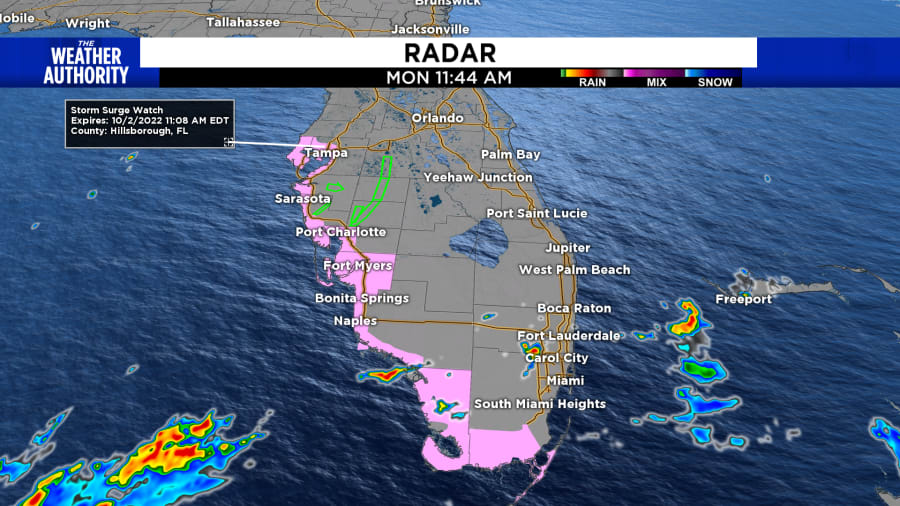
A Storm Surge Watch is in effect for the Florida Keys from the Card Sound Bridge westward to Key West, Dry Tortugas, Florida Bay, Anclote River southward to the Card Sound Bridge, and Tampa Bay.

A Storm Surge Watch means there is a possibility of life-threatening inundation, from rising water moving inland from the coastline, in the indicated locations during the next 48 hours.
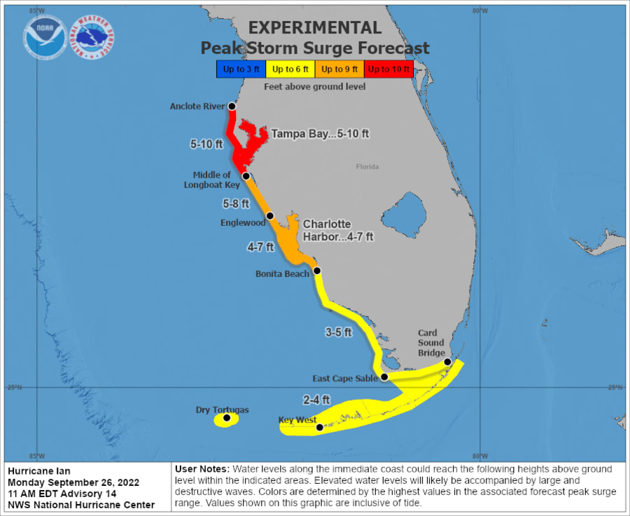
NOAA has an experimental storm surge forecast which calls for roughly 5-10 feet of surge pushing into the Tampa Bay area, 4-7 feet for Port Charlotte, and 3-5 feet for the Everglades.
Now the timing is everything when looking at these numbers.

If the highest surge were to occur during high tide, the water levels would climb quickly. A dangerous combination.
Looking ahead, Tampa Bay will see high tide Wednesday night at 5:32 p.m, and 4:25 a.m. Thursday morning. During this time Ian is forecast to be a major hurricane right off the coast. This is why the forecast calls for 5-10 feet of surge.
On top of the storm surge, we will also see high rainfall totals.
The Florida Keys are forecast to see 4 to 6 inches.
Central West Florida could see 8 to 10 inches, with local maxima up to 15 inches.
The remainder of the Florida Peninsula: 3 to 8 inches. Heavy rainfall is expected to affect North Florida, eastern portions of the Florida Panhandle, and portions of the Southeastern U.S. Friday and Saturday.


