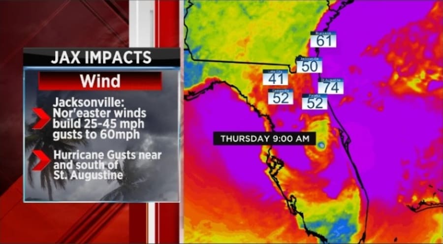
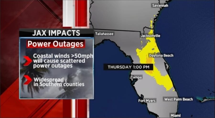
JACKSONVILLE, Fla. – I’ll make this quick, Jacksonville will be impacted, but as we pounded on-air last night, the biggest threats will be for our southern counties. Putnam, Flagler, southern St. Johns and Clay counties will take the brunt of Ian.
Jacksonville, Duval County, will see much greater impacts along area beaches, but if you live on the Northside or Westside, just a breezy/windy, rainy day coming your way on Thursday. Southside and Beaches will have much worse conditions. These will be highly disruptive conditions, and you should avoid getting out of the house.
Recommended Videos
Our southern counties will deal with potentially life-threatening conditions, especially for those along the St. Johns River and along the Atlantic Coast. Extreme rainfall rates and winds 50-60 mph with higher gusts should keep you locked down in your residence.
EXACT TRACK 4D: Here’s the latest projected path of Hurricane Ian
The bottom line is there will be a massive spread in conditions from the west (just wet) to the east (flooding) and from the north (breezy and cool) to the south (flooding). Southern Georgia will be largely spared, while the counties above south of Jacksonville may go without power for weeks.
Today (Wednesday) you should be finishing up outdoor cleanup, including bringing in patio furniture, potted plants and trash cans. You get the idea. I would also do laundry today and place the clean clothes in an area that is high and dry.
Ian is to pass through the area all day on Thursday. Prepare to remain alert throughout the day. Possible tornadoes along coastal areas south of Jacksonville throughout the day into the evening.
2022 HURRICANE SEASON: Latest Hurricane Ian track | Tracking the Tropics Interactive Map | Know Your Zone: Your flood risk | Plan & Prepare: Resources to be ready
IMPORTANTLY: IAN will be an all-day Thursday into Thursday night event for Jacksonville. Ian will be long gone by the time we get going on Friday morning. Friday will be a breezy, partly cloudy day.


