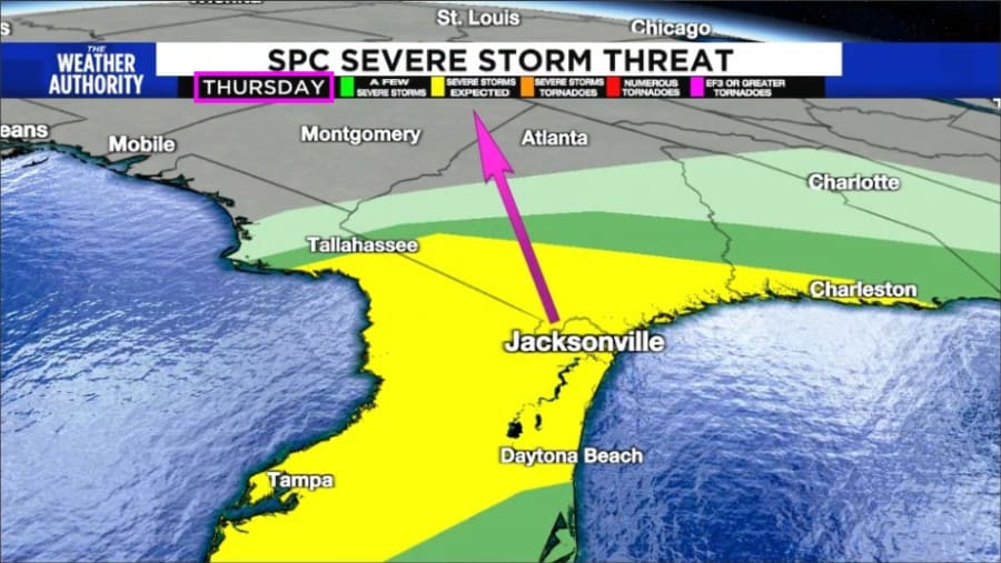
JACKSONVILLE, Fla. – The Storm Prediction Center has an elevated threat for possible isolated tornadoes associated with a few super-sell thunderstorms that will move through Southern Georgia and North Florida between 5 am and 1 pm Thursday.
The Weather Authority’s take?
Recommended Videos
Based upon the language of the statements from the Storm Prediction Center, there is a high probability we will see all or much of our area under a tornado watch or a severe thunderstorm watch as you wake up tomorrow morning.
Weather alerts are likely throughout the morning, even pre-dawn tomorrow.
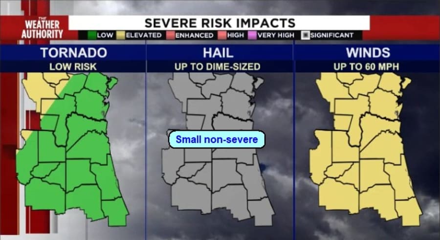
The storms heading our way will be on the weakening side of their life cycle, and we will only see scattered intense downpours and winds to 60 mph associated with a few severe thunderstorms. The tornado threat will be mainly for areas of Georgia just west and north of the Jacksonville area. In Florida, storms will primarily be along the Gulf Coast, with the greatest risk for severe storms.
I-75 from Gainesville to Lake City to Valdosta, Georgia, westward, will have the greatest risk.
What to do?
You should anchor down plants on apartment balconies and bring in empty trash cans and other loose outdoor items. Squalls may bring non-severe winds to 50 mph that can still push loose outdoor items around.
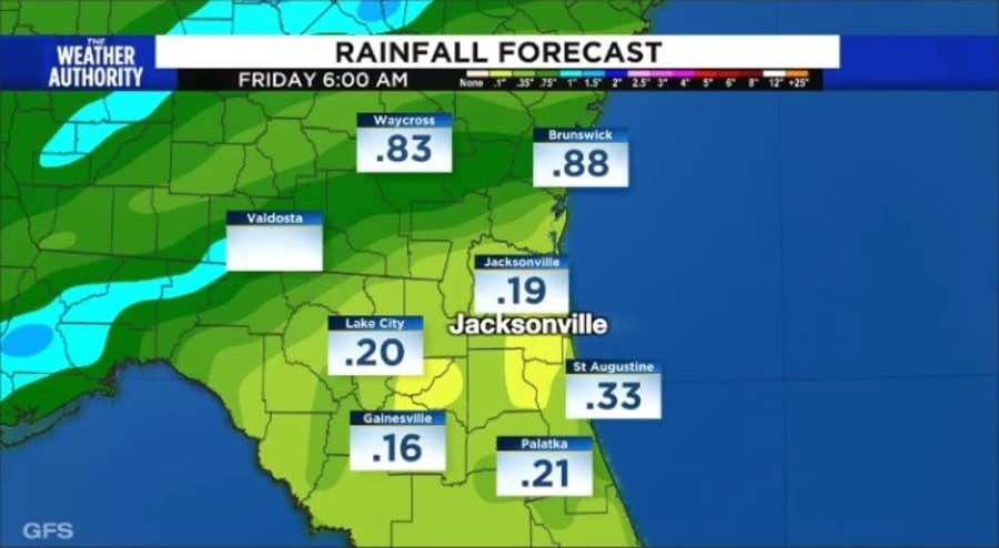
You should consider pushing errands and outdoor plans to the mid to late afternoon hours, as by 5 pm, as the sun sets, all the bad weather will have ended. Just a few lingering showers well south of Jacksonville, and cooler, drier conditions move in Friday.


