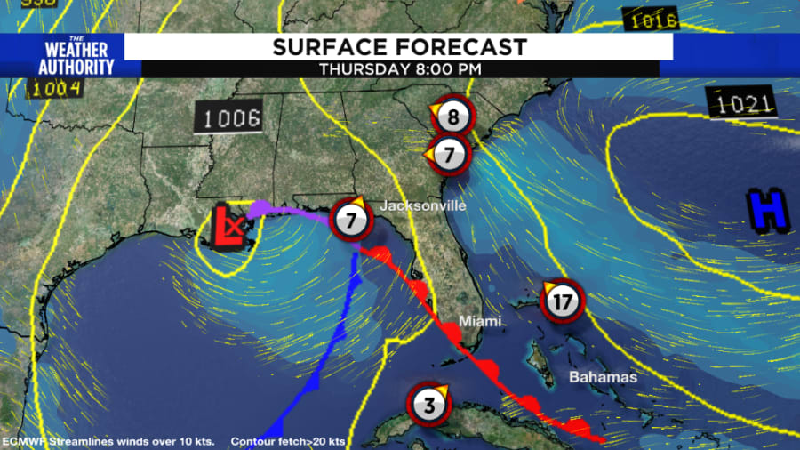
The gale whirling in the Gulf is quite different than a tropical cyclone threat we could see in the summer.
A storm in the Gulf is whipping up seas over 10 feet with heavy rain and wind and its generic name is Gale. The same name every time one blows.
Hurricanes and gales can both be powerful and dangerous, yet gales get no fancy track cone or special name from a list like hurricanes or tropical storms because they differ in their origins, formations, and impacts.
Non-tropical gales, also known as extratropical cyclones or mid-latitude cyclones, typically develop at Jacksonville’s latitude or farther north.
These types of storms are commonly attached to cold fronts, warm fronts, and occluded fronts.
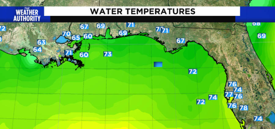
There is a reason why hurricanes favor a certain part of the year: warmer water and uniform temperatures over larger areas which routinely occur during the hurricane season.
This limits their formation to tropical regions, generally between 5 and 30 degrees north or south of the equator.
Unlike non-tropical gales, tropical storms rely on warm ocean waters to provide the energy needed to intensify and maintain their strength.
The gale in the Gulf is in 60° to 70° water which is far colder than 80 degree requirements for most tropical systems.
One of the most significant differences between non-tropical gales and tropical storms is their impact area.
Non-tropical gales can affect large regions, spanning hundreds or even thousands of miles, and may produce a variety of weather conditions such as rain, snow, and strong winds.
In contrast, tropical storms are typically smaller and more localized, with the most severe impacts occurring in the eye wall and eyewall replacement cycle.
The intensity of the storms is also a significant factor.
Non-tropical gales can have strong winds and heavy precipitation, but their winds are limited in strength because of the broader nature of the system’s size.
Tropical cyclones can power up with winds over 160 mph in favorable environments over warm water.
Non-tropical gales form around strong temperature gradients due to strong upper-level winds at higher latitudes. Those upper level winds are detrimental to tropical systems since the winds tear the storm structure apart.