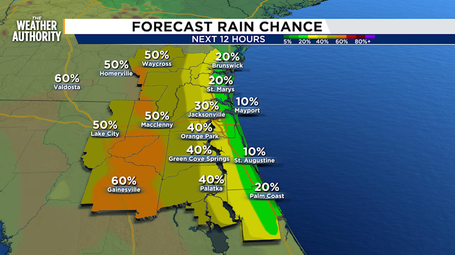
Our daily storm pattern has backed off tonight and it will stay on the low side Saturday before ramping up again with numerous storms on Sunday.
Evening showers stay well clear of NE FL and Georgia tonight and will remain toward I-75.
Feels like temperatures on Saturday will top over 110 in the afternoon with air readings near 95. The beaches will stay in the 80s with a sea breeze generating a moderate risk of rip currents. It will be dry at the beach with scattered inland storms mainly around and west of the St. Johns River.

The few storms that develop will drop heavy rain due to the extra humidity and lack of any real steering flow.
Sunday sees an uptick in the storm coverage with continued heat in the low to mid 90s while cool front stalls over central Georgia.


