JACKSONVILLE. FL – Ever wondered why it seems to storm almost every day in Jacksonville during the summer? The answer lies in three key ingredients that combine to create the perfect rain environment: moisture, unstable air, and lift.
These ingredients are present in Florida more frequently during the summer months, leading to the high frequency of thunderstorms.
But what about the days with particularly heavy rain? While the presence of the three ingredients is important, the amount of rain an area receives depends on the specific atmospheric setup.
Research by the National Weather Service has shown that these heavy rain events are influenced by two key factors: moisture content and steering flow patterns.
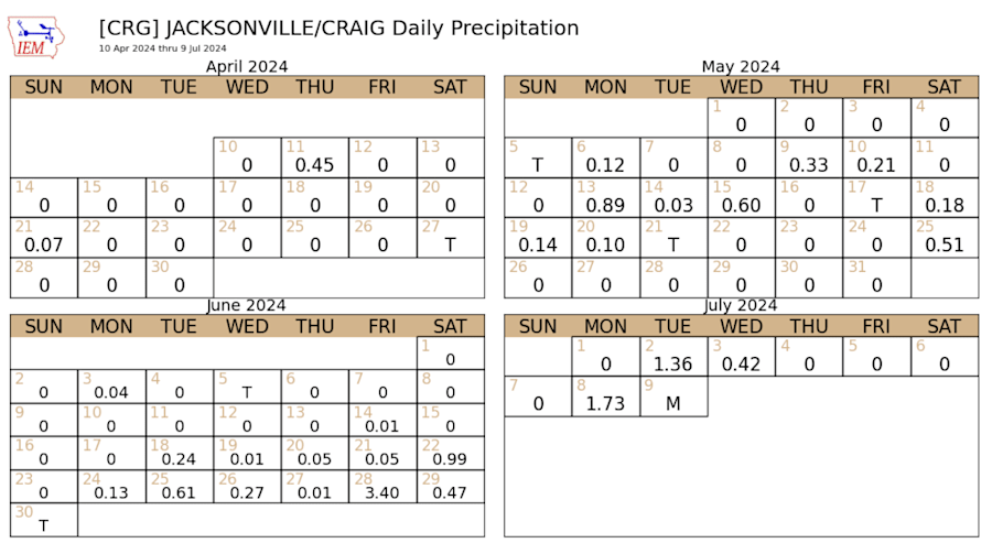
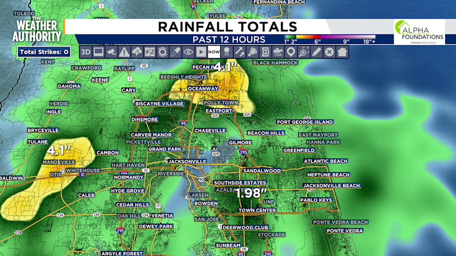
Both resulted in flash flooding Monday with over four inches of rain falling in just over an hour across Duval County.
Moisture: The Fuel for Rain
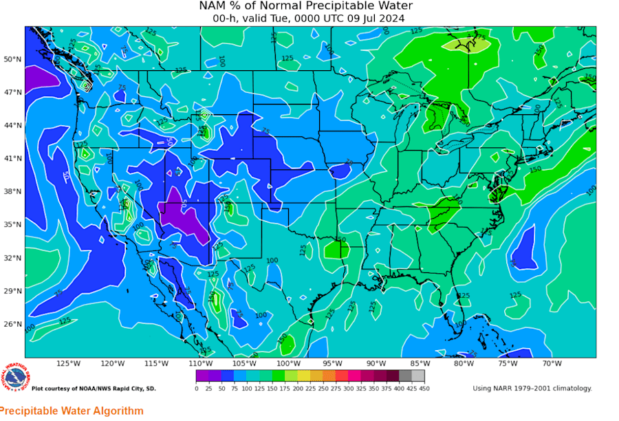
One factor is the amount of moisture available in the atmosphere, often measured as precipitable water (PW) content. Think of PW as the total amount of water vapor that would be condensed if all the moisture in a column of air was rained out. During heavy rain events, the PW content is typically well above normal.
A weather balloon measured the PW at currently 30% above average This extra moisture, like extra fuel in a car, can lead to heavier rain rates.
For example, in Monday’s rain event, some areas received over 4 inches of rain south and east of the Airport and west of Marietta.
Steering the Storms: How Winds Influence Rainfall
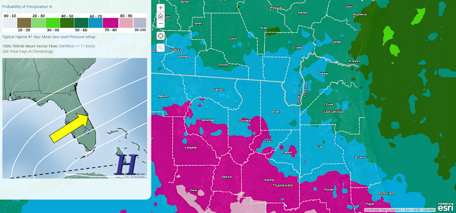
The second factor is the steering flow pattern, which is the winds aloft that help guide the movement of storms. Decades of research by the NWS have identified a specific steering flow pattern that’s most likely to bring frequent rain.

When the average steering winds between the surface and 10,000 feet are from the southwest to west and blow at speeds between 4 and 11 knots, the Jacksonville area experiences its wettest conditions, with rain occurring 60 to 80% of the time.
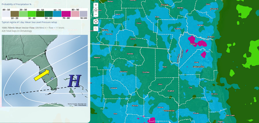
Interestingly, the NWS research also shows that when these winds exceed 11 knots, rain becomes more likely in areas along the Nature Coast, Suwannee Valley, and Flagler and Putnam counties.
When the conditions are right summer downpours can go into overdrive with a deluge.