A substantial influx of African dust is expected to reach Florida this weekend, extending into the northern part of the state by Sunday.
The Saharan Air Layer (SAL) aerosols scatter light, enhancing sunrises and sunsets while potentially causing moderate air quality issues depending on particle dispersion to ground level.
This dust season peaks from late spring through early fall, spanning the North Atlantic from the Sahara Desert to the West Indies, occasionally reaching as far as Florida and Texas.
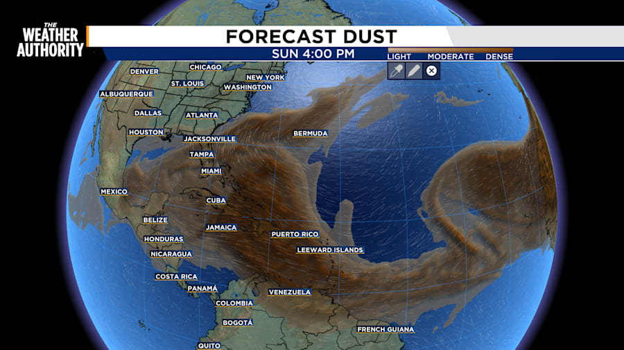
SAL activity intensifies in early June, peaking from mid-June to late July, and tapering off by early August. These dusty outbreaks, spanning the width of the United States, move across Africa’s coast every 3-5 days, cruising at altitudes of 5,000-18,000 feet.
The SAL’s dry, sinking air and reduced moisture content significantly suppress tropical cyclone formation. The layer’s mineral particles absorb sunlight, maintaining temperatures 9°-18°F warmer than moist tropical air. This warm-over-cool air creates an inversion, stabilizing the atmosphere and inhibiting thunderstorm development. On average, the SAL increases atmospheric stability by 40%, diminishing cloud and thunderstorm formation.
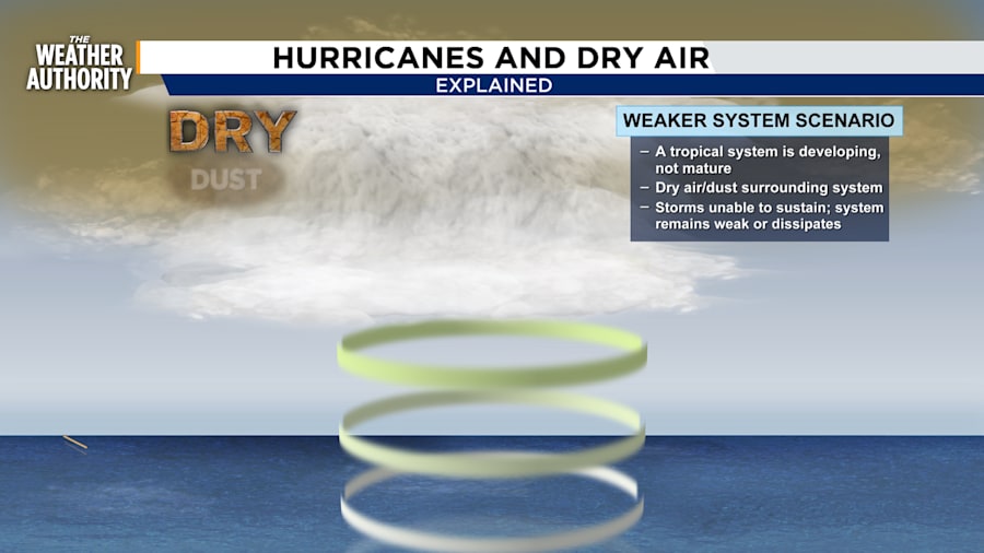
Although many storms struggle to intensify within the SAL’s influence, exceptions occur. Storms occasionally defy the layer’s constraints and intensify despite the surrounding hostile environment.
Beryl, notably, became the earliest Category 4 hurricane on record in the Atlantic, sustaining winds of 130 mph. Originating from an African Easterly Wave in the “main development region” (MDR) of the tropical Atlantic, Beryl’s formation outside the peak SAL season was unusual. The MDR typically becomes active in August and September as SAL influence wanes.
Beryl tracked south of the SAL, maintaining compact form while benefiting from sea surface temperatures currently 2-4°F above average across most of the MDR.