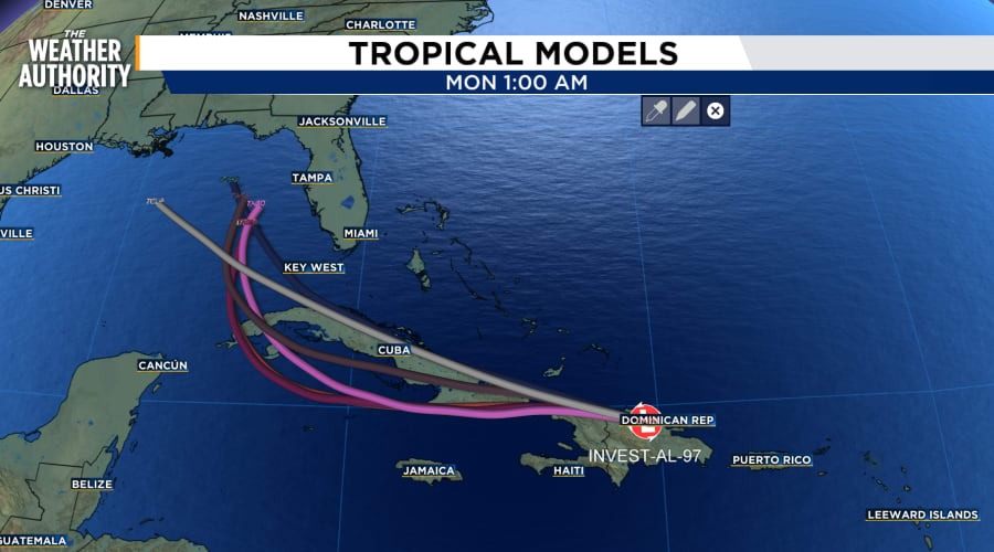
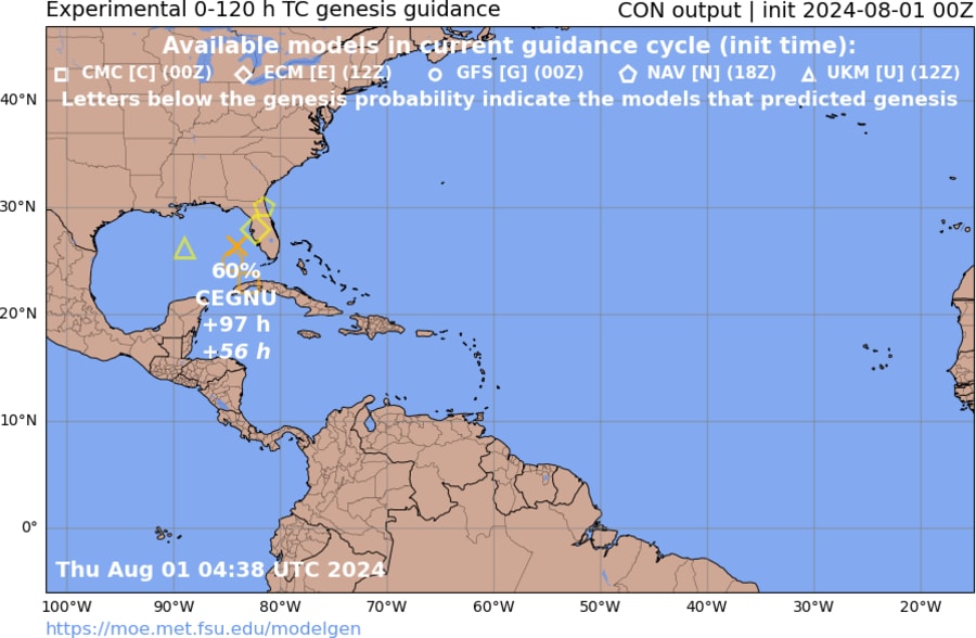
JACKSONVILLE, Fla. – As Tropical Wave Invest 97 tracks toward the Gulf of Mexico this weekend it has the potential to stall out and bring heavy rain to certain areas which all depends on a developing blocking pattern.
One of the key factors to watch is how the tropical wave interacts with whats known as an “atmospheric col.” Understanding how these cols work can shed light on why certain storms, such as Hurricane Harvey, can stall and unleash devastating amounts of rain.
What is an Atmospheric Col?
An atmospheric col is a region in the atmosphere characterized by weak pressure gradients between high and low-pressure systems. Imagine a weather map showing several high and low-pressure areas; a col is the zone where these systems’ influences cancel each other out, resulting in very weak or calm winds.
How Does an Atmospheric Col Affect Tropical Cyclone Movement?
Tropical cyclones are steered by larger-scale wind patterns in the atmosphere. When a cyclone encounters an atmospheric col, the steering currents become weak or nearly non-existent. As a result, the cyclone can slow down dramatically or even become stationary. This stalling effect can lead to prolonged periods of heavy rainfall and increased potential for flooding.
Technical Example
Let’s consider Invest 97 approaching the Gulf as a col sets up. Under normal conditions, the wave might be steered by strong easterly trade winds toward Texas. However, as it moves into the col:
- Weak Steering Winds: The lack of strong steering currents means the cyclone’s forward motion slows down. It may meander or loop in place, influenced only by minor and local wind variations.
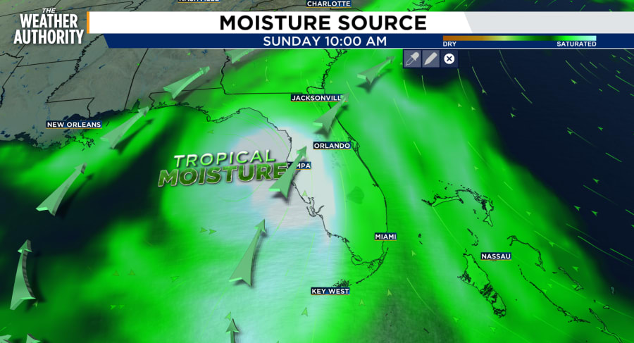
- Prolonged Rainfall: With the cyclone’s movement stalled, the same areas are subjected to heavy rainfall for extended periods. This can lead to heavy flooding if it stalls in the northeastern Gulf and pumps up abundant moisture into Florida or the northern Gulf states.
- Increased Impact: The prolonged exposure to warm Gulf waters, especially across the Loop Current in the mid/upper 80s may increase the potential for development into a strong wind storm.
Case Study: Hurricane Harvey
Let’s consider the wettest hurricane in the United States. Hurricane Harvey is a prime example of a storm that stalled due to calm steering winds. Initially, Harvey made landfall near Rockport, Texas, as a Category 4 hurricane. After landfall, it moved inland but soon encountered a region of weak steering currents, effectively a col.
- Stalling Effect: Harvey’s forward motion slowed significantly, and the storm stalled over southeastern Texas for several days.
- Record Rainfall: The slow movement allowed Harvey to dump unprecedented amounts of rain over a 4 day period. Some areas received over 60 inches of rain, leading to historic flooding, particularly in the Houston metropolitan area.
- Devastation: The prolonged heavy rain overwhelmed rivers, bayous, and reservoirs, causing widespread flooding, displacing thousands of residents, and resulting in significant economic and infrastructural damage.
Implications for Jacksonville
The disorganized tropical wave may not develop into anything until late Sunday or next week, which is too early for residents of Jacksonville to know the exact rain potential at this point.
But, understanding the behavior of this potential setup would explain the heavy rain we could get next week if the col sends a plume of tropical moisture or a developing tropical cyclone northward.