

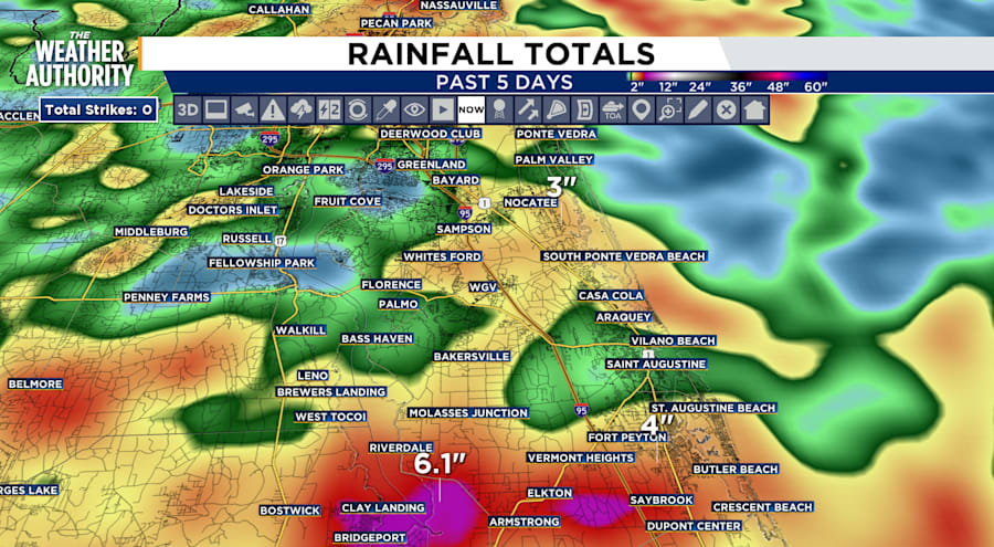
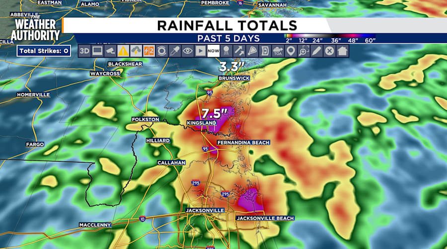
The daily record of rainfall for this day was 4.46 inches in 1995 and though we are not anywhere near that total for the next 24 hours, the soil is saturated from days of rainfall. Parts of SE Georgia and NE Florida are seeing five day totals range from 2 to over 7 inches of rain.
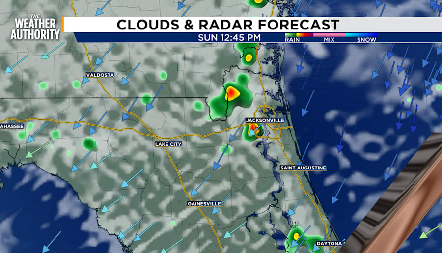
Morning temperatures will begin in the low to mid-70s with mostly cloudy skies and light winds from the north. Rain returns in the early afternoon with isolated light to moderate rain near the Florida-Georgia border. Rain will end around sunset.
Click here to see the county-by county Coastal Flood Monitoring from the National Weather Service.
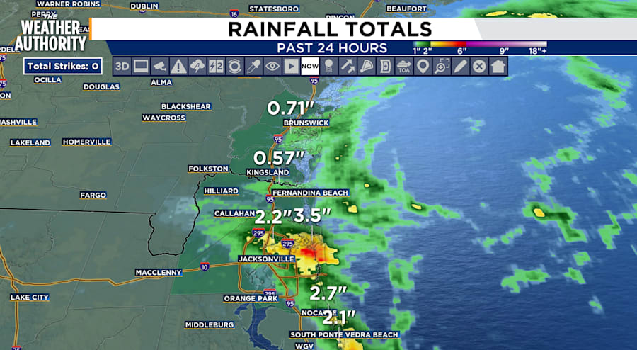
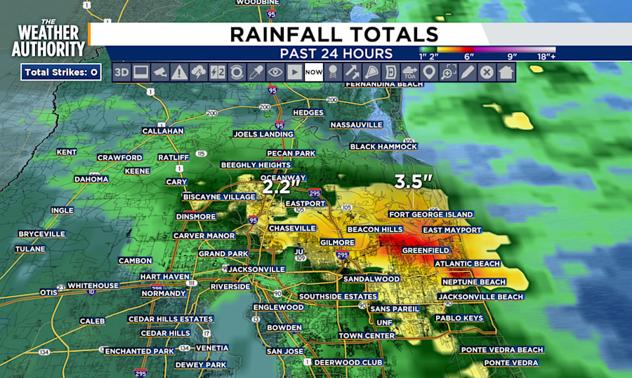
Rain accumulation graphics show totals since Saturday 5 PM for the last 24 hours
The graphics below show rain accumulation over the last five days as of Saturday, August 24th at 6:00 PM (EST)

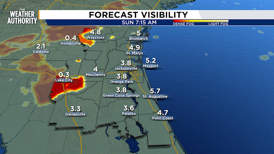
OVERNIGHT COMMUTE WARNING
There is a chance for fog in the early morning from 5 to 9 am near the I-10 and I-75 corridor and parts of I-95 in Southeast Georgia.
LOOKING AHEAD: Tracking the Tropics
Models remain highly inconsistent however there is a chance for a system to develop in the tropics at the beginning of September. Models currently shows variations in where the system would develop but likely in the Gulf following similar patterns of this hurricane season.
