JACKSONVILLE, Fla. – The stationary front won’t let up in time to avoid a Friday afternoon of heavy downpours that will affect the drivetime and high school football kick-offs across our region.
RELATED: ‘This is ridiculous’: Councilman seeks answers from Public Works over San Marco flooding | Half-mile section of Old St. Augustine Road near San Jose Boulevard merge closed due to flooding
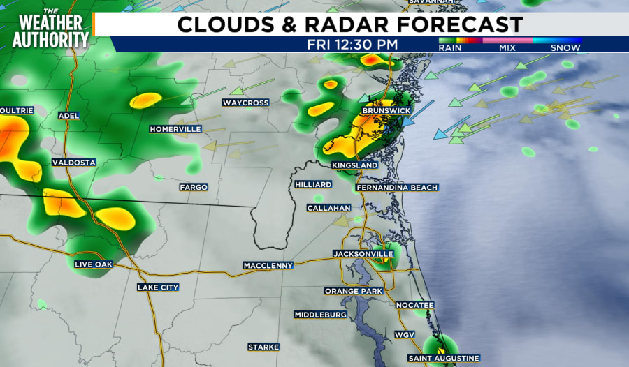
After days of relentless rain with nowhere left to drain, more is on the way Friday afternoon. Starting in Southeast Georgia around lunchtime, the stalled front will bring onshore winds and rain to the coastal counties before moving inland. As much as an inch of rain can cause more flooding conditions in these already saturated areas.
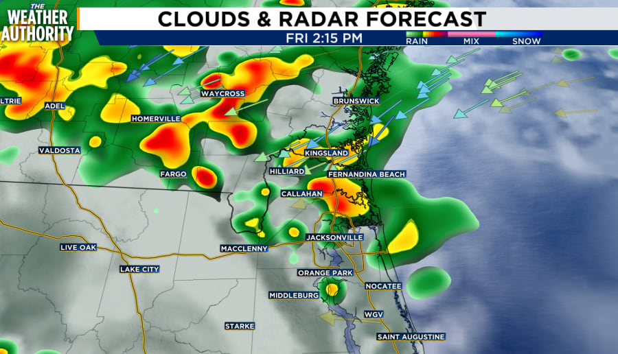
By 2 p.m., Northeast Florida will begin to see the impacts from the stalled front with heavy downpours. Areas such as San Marco, Bowden, and Mandarin have already seen 5-8″ of rain since Monday and don’t have the capacity to endure much more.
Cloud coverage will remain across the entire region as showers continue to build throughout the afternoon.
By 6 p.m., Friday night high school football games will need to be monitored closely for wet conditions. While the showers won’t be severe, heavy downpours and gusty winds will be a factor.
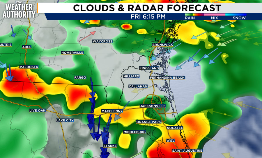
A Flood Watch remains in effect until 6 a.m. Saturday morning for inland Nassau, Camden, Glynn counties, as well as coastal Duval, Nassau counties.