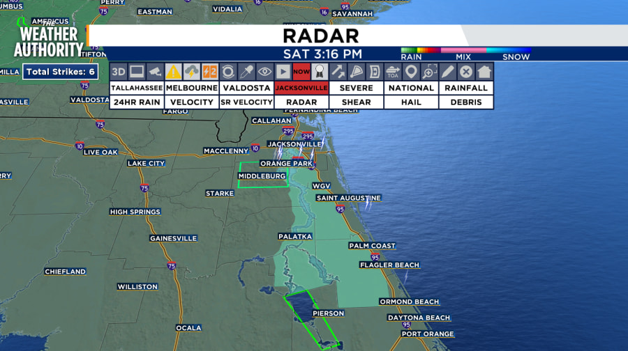
Minor flooding could occur in low-lying and poor-drainage areas. Rain accumulation is between half an inch to one inch.
Some areas that could experience flooding include: Orange Park, Green Cove Springs, Middleburg, Oakleaf Plantation, Doctors Inlet, Lakeside, Fleming Island, Bellair- Meadowbrook Terrace, Penney Farms and Asbury Lake.
COASTAL FLOOD ADVISORY:
All communities along the St Johns River including
Duval, Clay, St Johns, Flagler and Putnam until through Sunday
Please see advisories in mint green color below.

TONIGHT:
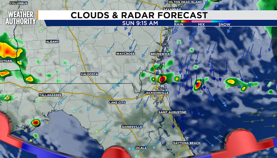
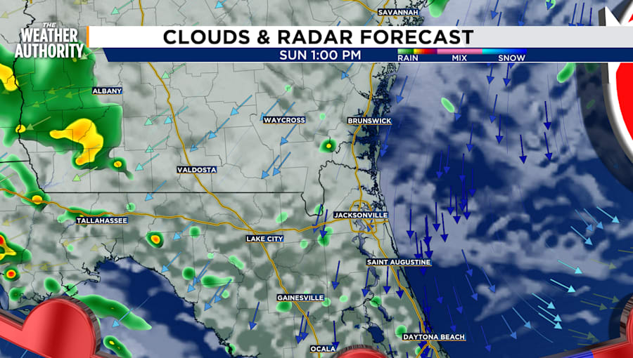
Isolated rain will continue predominately in Northeast Florida along I-95 and the St Johns River before moving toward the beaches. There will be heavy downpours with this round of storms. This will occur from 3 pm until 7 pm. Then, small isolated storms will continue for the inland counties from Columbia to Alachua through midnight. The rain will impact Northeast Florida more than Southeast Georgia.
Temperatures will remain in the low 70s, with high humidity, mostly cloudy skies, light traces of rain and winds from the north and northeast. Winds will be in the 5 to 10 miles per hour range for Northeast Florida however, winds will be in the teens and 20s for Southeast Georgia.


GALE WARNING:
Boaters please be aware of a gale warning for the Atlantic continental shelf and slope waters beyond 20 nm to 250 nm offshore, including south of Georges Bank from 1000 fm to 250 nm offshore.
Seas given as significant wave height, which is the average height of the highest 1/3 of the waves. Individual waves may be more than twice the significant wave height.
HIGH RIP CURRENT RISK:
Southeast Georgia and Northeast Florida Beaches through Monday evening
TRACKING THE TROPICS:
According to the National Hurricane Center, this afternoon, Tropical Storm Gordon was located near latitude 20.3 North, longitude 42.9 West. Gordon is moving toward the west near 9 mph (15 km/h). A slightly slower westward or west-southwestward motion is forecast during the next several days. Maximum sustained winds are near 45 mph (75 km/h) with higher gusts. Gordon will likely weaken this evening and become a tropical depression.
Gordon is in an environment with wind shear and dry stable air, two things that will decrease the chances of Gordon intensifying into a stronger storm.
Off the coast near the Carolinas is a non-tropical area of low pressure system. However, the system could develop subtropical or tropical characteristics. A subtropical or tropical depression or storm could form. Formation chance through 48 hours is 40 percent. Formation chance through 7 days 50 percent.
LOOKING AHEAD:
Rain chances remain going into next week however, there will be more sun days in the week. A possible low pressure system will likely be the cause for rain along the coast at the beginning of the week as a storm develops in the Carolinas.


