
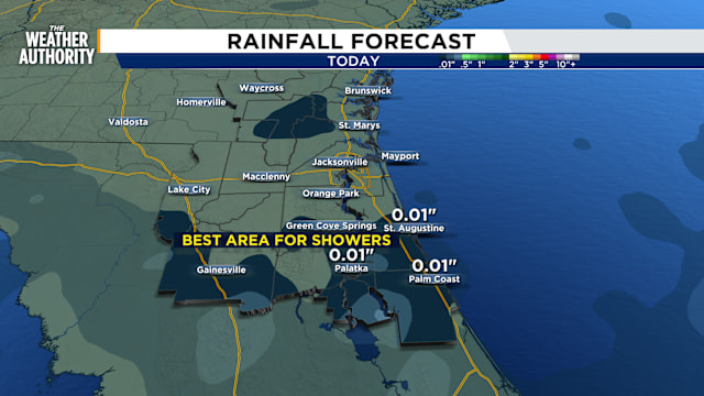
The sun shines brighter today, and the rain takes a break as drier air moves into the area. This will suppress storm activity around Jacksonville, and areas northward through Georgia should remain dry today. However, there is a chance of isolated showers this afternoon and early evening, mainly around southern Clay and St. Johns counties and areas toward Central Florida, where moisture levels will remain higher. Temperatures will climb into the mid to upper 80s. Westerly winds will make it feel hotter, with only a minimal sea breeze near the coast. Flooding is possible along the St. Johns River during high tides due to elevated water levels. Seas will decrease, leading to weaker rip currents today, but onshore winds over the weekend will create hazardous beach conditions later on.
A break in the rainy pattern is ahead
Only isolated southern showers
Copyright 2024 by WJXT News4JAX - All rights reserved.


