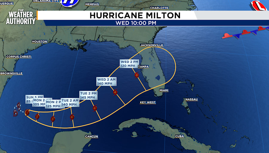
There are currently three active hurricanes but the focus is on Hurricane Milton as it heads toward Florida’s Gulf Coast.
Hurricane Milton
Hurricane and Storm Surge Watches could be required for portions of Florida late Sunday.
The center of Hurricane Milton was located by an Air Force Reserve Hurricane Hunter aircraft near latitude 22.5 North, longitude 94.0 West. Milton is moving toward the east near 6 mph, and this general motion is expected Sunday. An eastward to east-northeastward motion is forecast on Monday, followed by a faster northeastward motion on Tuesday and Wednesday.
Milton is expected to make landfall on the Gulf side of Florida by the middle of the week.
Currently, maximum sustained winds have increased to near 85 mph with higher gusts.
Milton is forecast to rapidly intensify during the next couple of days and become a major hurricane on Monday. It was a Category 1 as of the 8 p.m. update.
Hurricane-force winds extend outward up to 20 miles from the center and tropical-storm-force winds extend outward up to 80 miles from the center.
The estimated minimum central pressure is 988 mb (29.18 inches) based on Air Force dropsonde data. Some models show the storm dropping in pressure to a Category 3 hurricane as it shifts northeast toward Florida.
IMPACT
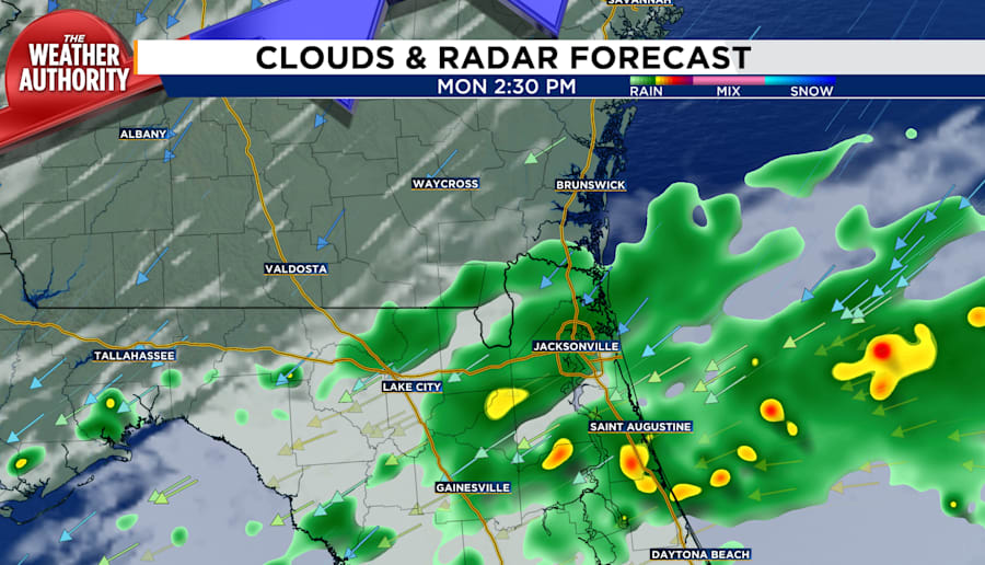
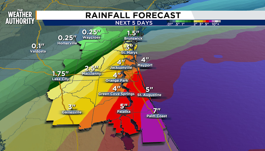
RAIN: Rainfall projections are currently at 2 to 12 inches. The low accumulation begins in Southeast Georgia and increases closer to Flagler, Putnam and Volusia counties. Flash flooding probabilities range from 15 to 40% with Southeast Georgia at the lowest risk and counties south of I-10 and along the coast with the higher changes.
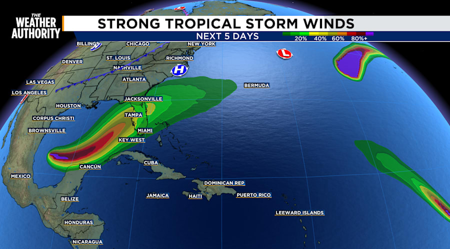
WIND: As of Sunday we have a 10 to 40% chance for tropical storm-force winds as Hurricane Milton makes landfall. Tropical storm force winds are at a minimum of 39 miles per hour, sustained for at least 60 seconds and up to 73 miles per hour. Anything above 73 miles per hour is considered hurricane-force winds. Arrival time for winds could start as soon as late Tuesday evening and early Wednesday morning, well before the eye makes landfall.
Hurricane Kirk
SURF: Swells generated by Kirk are affecting the Leeward Islands, Bermuda, the Greater Antilles, the Bahamas, and the east coast of the United States. These swells will continue spreading northward along the east coast of the United States and Atlantic Canada today, and to the Azores on Monday. These swells are likely to cause life-threatening surf and rip current conditions. Please consult products from your local weather office.
Hurricane Leslie
Has no threat to land.
Current Disturbance
Far Eastern Tropical Atlantic:
A tropical wave is expected to move off the west coast of Africa in a few days. Some development of this system is possible thereafter while it moves westward or west-northwestward across the eastern tropical Atlantic. The system is expected to move near or over the Cabo Verde Islands on Wednesday and Thursday, and interests there should monitor its progress.* Formation chance through 48 hours...low...near 0 percent.* Formation chance through 7 days...low...30 percent.
LOCAL FORECAST
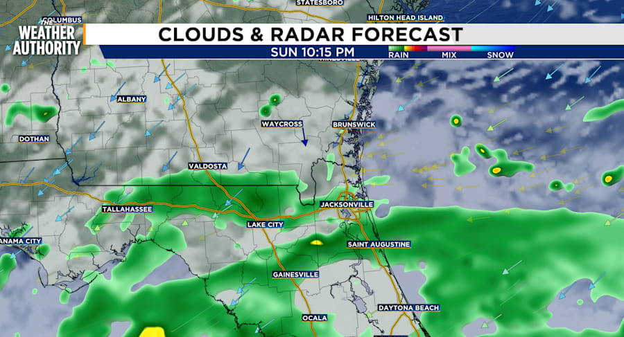
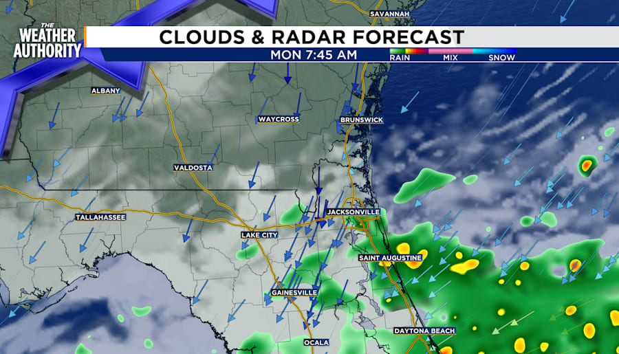
Rain remains light to moderate for Southeast Georgia and Northeast Florida through the evening.
Temperatures will drop into mid to low 70s Sunday night with winds between 5 and 7 miles per hour from the northeast. Clouds will remain throughout tonight. Rain accumulation will be half to .75 inches between now and midnight Monday.