There is a disturbance in the Central Tropical Atlantic. It is referenced as “AL94.″ It is now a “well-defined” area of low pressure located roughly midway between the Cabo Verde Islands and the Lesser Antilles.
Storms and thunderstorms are visible from satellite images. The disturbance will continue moving west and could develop into a tropical depression; however, it is not highly likely to develop due to it being surrounded by a dry environment.
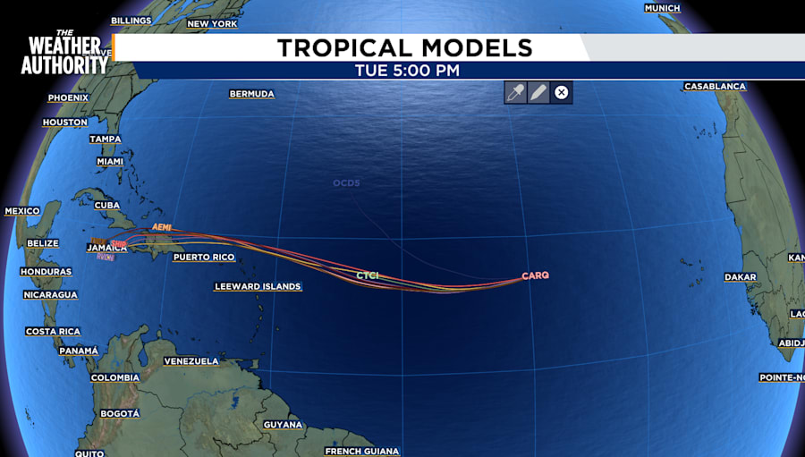
Formation chance through 48 hours is 30%. Formation chance through 7 days is 60%.
A disturbance in the Western Caribbean Sea is located generally near the areas where Helene and Milton developed at different periods of time. The disturbance is currently a broad area of low pressure and is likely to form over the southwestern Caribbean Sea by the middle to latter portions of this week. The system is moving toward Central America.
Formation chance through 48 hours is 0%. Formation chance through 7 days is 30%.
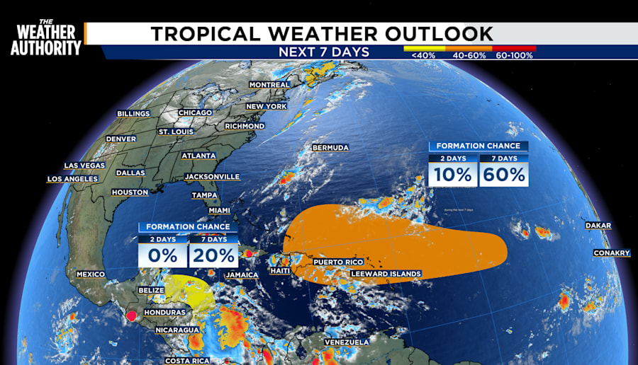
Long-term models do not show either disturbance impacting Florida, however, storm development is fluid and can change quickly.