

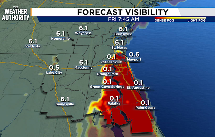
Mostly clear to partly cloudy skies and areas of fog developing after midnight. Patchy to dense fog will be possible inland as well as along our coastal counties through around 9 am.
A warm Friday on tap with a slight chance of showers late Friday night. Showers will move through overnight and clear the area Saturday morning. Temperatures will cool a little, but remain above seasonal norms.
Tonight: Partly cloudy with patchy to dense fog overnight.
Friday: Patchy to areas of dense fog through around 9 am. Becoming partly cloudy during the afternoon then cloudy Friday night with a slight chance of showers after 8 pm, 20 percent. Morning lows in the 50s. Afternoon highs in the 70s to low 80s. Wind: SW 10-15 mph. Cloudy with showers overnight.
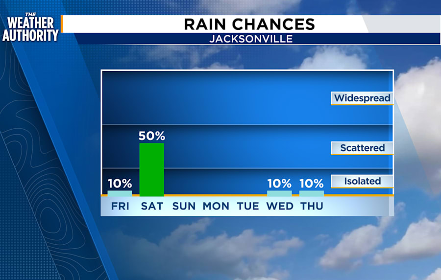
Saturday: Scattered showers overnight then ending after sunrise, 40 - 50 percent. Cloudy skies early then becoming partly cloudy. Wake up temperatures in the 50s. Afternoon highs in the 60s to low 70s. Wind: NNE 5-10 mph. Mostly clear skies overnight.
Sunday - Monday: Temperatures will be warm for this time of year, but well within Open Window Weather range.
Sunrise: 7:18 am
Sunset: 6:02 pm


