Clear skies will give way to high clouds and patchy fog late tonight as temperatures cool with light wind. A chilly start to Saturday with warmer afternoon highs.
Another dry-cold front will move through the area late Saturday for a cooler and breezy Sunday.
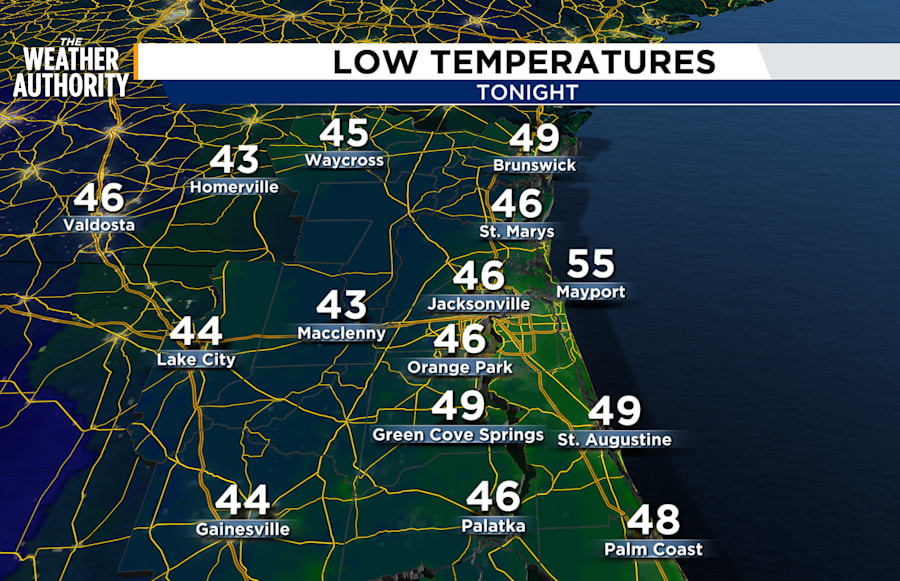
Saturday: A pleasant afternoon under sunny skies. A chilly start to the day with morning lows in the 40s inland, low 50s along the beaches. Afternoon highs in the 70s. Wind: SW 5-15 mph. Mostly clear overnight as a dry front slips south.
Sunday: Cooler and breezy under sunny skies. A little cooler Sunday with highs a little shy of seasonal norms. Wake up temperatures in the 40s for SE GA, 40s to low 50s for NE FL. Afternoon highs in the 60s inland and along the sandy shores. Wind: NNE 10-15 mph.
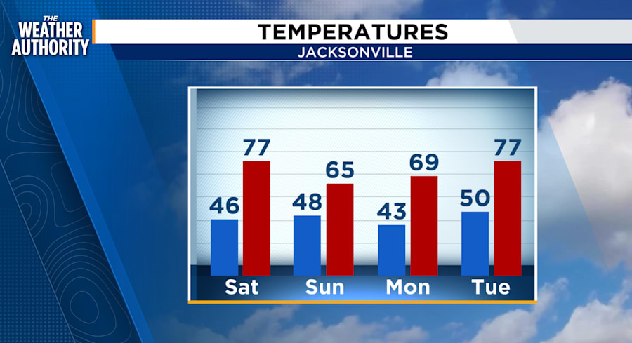
Looking ahead: Cooler temperatures continue Monday with warmer temperatures and increasing rain chances Wednesday. We will be watching the midweek forecast closely as some models are hinting at the chance of thunderstorms, some severe, on Wednesday afternoon.
Sunrise: 6:53 am
Sunset: 6:24 pm