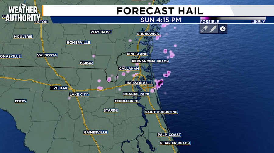
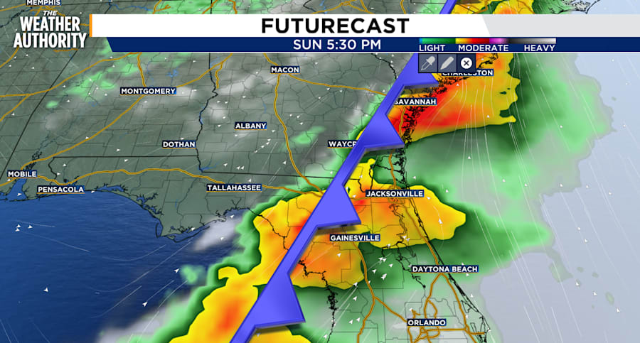
JACKSONVILLE, Fla. – The first rounds of rain will reach Southeast Georgia by sunrise Sunday morning before moving south into Northeast Florida around noon. The storm will move quickly keeping flooding to a minimum as well as accumulated rainfall totals. However, heavy downpours, gusty winds up to 50+ mph, hail, and a low chance of an isolated tornado threat remain the main concerns. The system will move offshore by sunset.
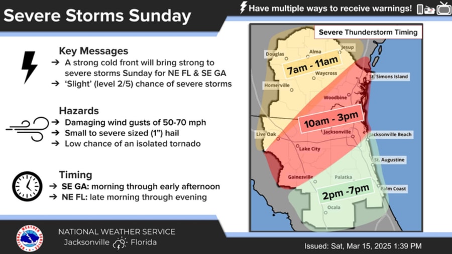
Beginning early Sunday morning, the system will first approach Southeast Georgia counties. The timing and heating will determine the intensity of the storms early in the day. As the system traverses from the northwest to the southeast, and heating occurs throughout the day, the storms are likely to increase in intensity.
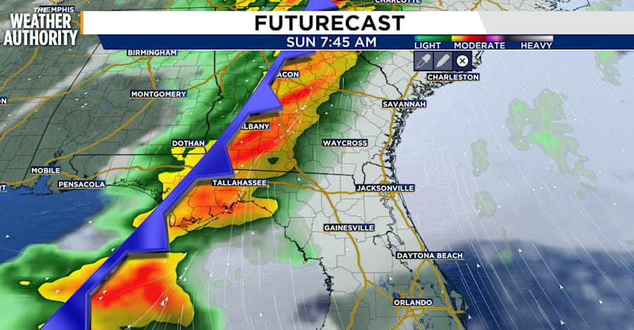
Rain is unlikely before Noon in Jacksonville but it will arrive earlier in Georgia and along the I-75 corridor.
Be sure to have an escape plan if you plan to be outdoors when lightning flairs up around 2-5 p.m. Sunday especially as some storms may bring dangerous gusts.

The worst of the weather will be offshore by Sunday night as the cold front moves offshore toward sunset. Cooler air will settle in behind the front keeping highs on Monday below average in the upper 60s, low 70s.