JACKSONVILLE, Fla. – It may take a tropical storm to finally bring an end to Jacksonville’s daily downpours.
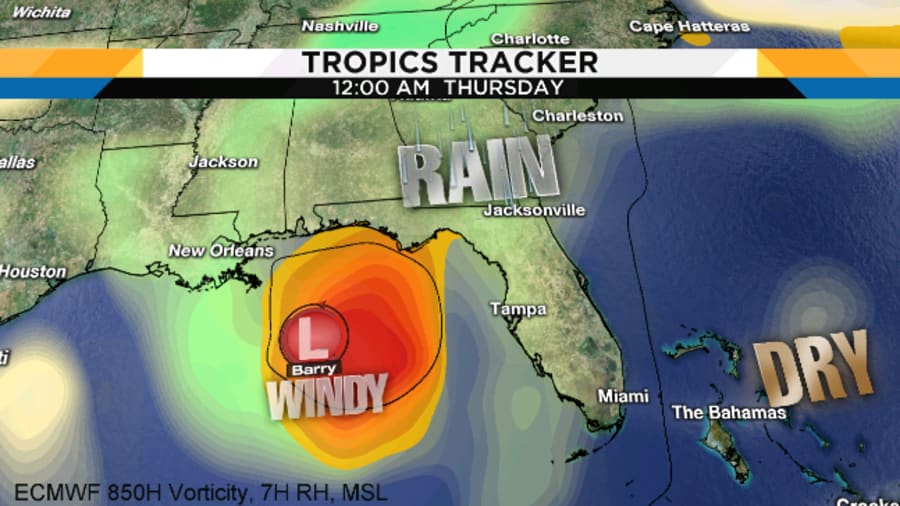
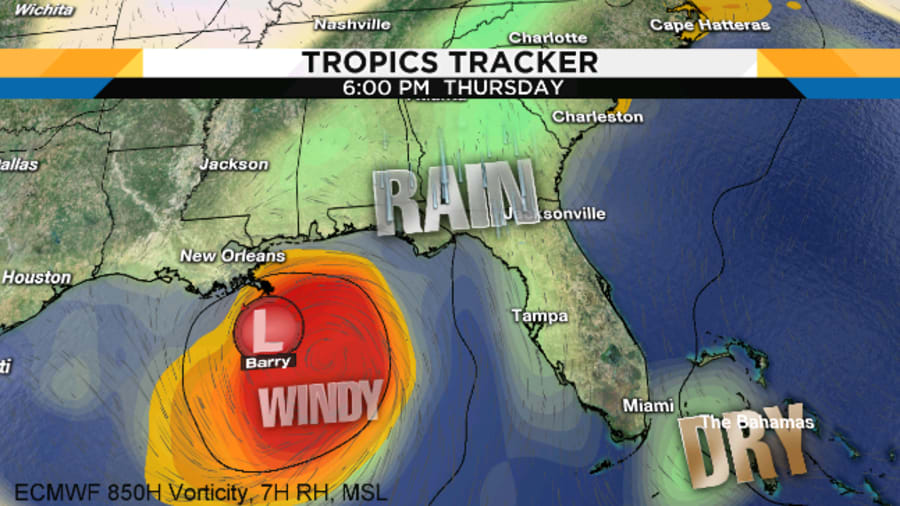
It appears a tropical storm could form in the Gulf of Mexico later this week, and while it sounds convoluted, the event could finally bring a pause in the daily thunderstorm cycle.
The National Hurricane Center gives the area in the northeastern Gulf an 80% chance of developing later this week. Those are good odds for something that is actually nothing as of now.
Recommended Videos
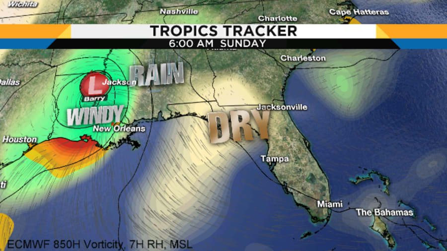
The abundant moisture fueling Northeast Florida's daily downpours would feed the developing Gulf system and eventually drag our wet weather away toward the end of the week, depending on the system's evolution in the days to follow.


Until clouds form, models will vary drastically in any precise path or outcome.
How can something form when currently there are no tropical disturbances or easterly waves in the Gulf or Atlantic?
Here's how it lays out:
First - there is absolutely nothing in the Gulf to track now.
Second - if or when a disturbance forms it would be after Wednesday night.
Third and most importantly -- the wind and rain would likely head away from Jacksonville toward Louisiana or Florida’s Panhandle.
It's all because of a classic June/July northern Gulf tropical development set-up.


If this plays out as expected, Tropical Storm Barry could impact the northern Gulf states by the end of the week.
There is a high probability (80%) that a tropical depression is likely to form by the end of the week over the northern Gulf of Mexico. This system also has the potential to produce heavy rainfall along portions of the northern and eastern U.S. Gulf Coast later this week. pic.twitter.com/fm8BnAh26O
— National Hurricane Center (@NHC_Atlantic) July 8, 2019


