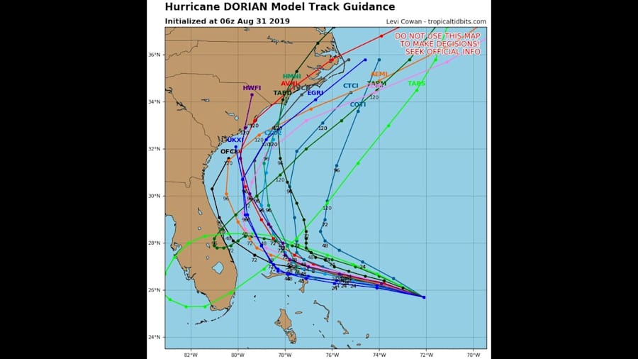
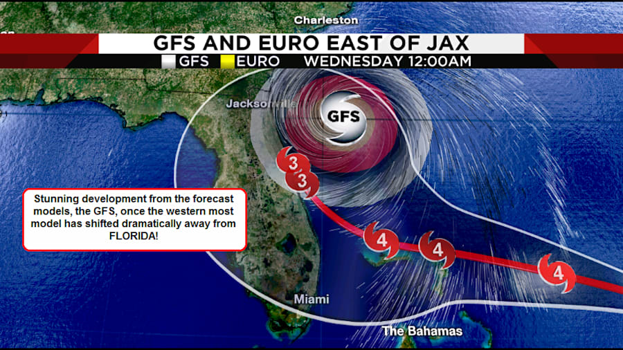
JACKSONVILLE, Fla. – Despite the 11 pm Friday updates (and now the 5 a.m. Saturday updates) on Dorian from the National Hurricane Center (NHC), there were strong indications that Dorian would pass well east of Florida.
Basically, forecast models had been shifting further and further eastward throughout the day on Friday.
Recommended Videos
The trend, is our friend.
The shift to the east in Dorian forecast track forecasts, meant the trend was our friend. Tracks shifting east meant Dorian would remain off shore.
Amazingly, the models, in just 24 hours, had gone from Dorian goes west across the State of Florida into the Gulf of Mexico, to Dorian goes to the west coast then turns north, then the next model run suggested, a track up the backbone of the State to Orlando, and that was followed by a run up the East coast of the State.
Back to back to back to back an eastward shift in hurricane forecast models.
So when, the National Hurricane Center forecast tracks came out at 5 a.m., it really should be no surprise that their forecast tracks showed a shift to the east with the probability that Dorian remaining at sea, off the East coast of Florida and never making landfall.
They wrote this in their 5 a.m. discussion:
"The track forecast becomes much more problematic after 48 h. The global models the NHC normally uses, along with the regional HWRF and HMON models, have made another shift to the east to the point where none of them forecast Dorian to make landfall in Florida."
Sweet words to read/hear...

This is where we stand this Saturday morning.
Despite all the shifting, there will always be the chance the models again shift, this time west. Plus, Dorian will become a monster size hurricane, not just intense but rather large as well.
Therefore, don't become complacent, remain ready to act, just in case he does spin back westward.
There are indications he could still directly impact Georgia or the Carolinas.
All of us in North Florida and Southeast Georgia need to remain super vigilant to this possibility.
Remember Dorian is a major hurricane and his impacts will be felt far from his center or "eye". Beach erosion and large surf, large rip currents will be expected based upon the latest forecast models and these serious Coastal conditions can kill.
Don't let your guard down!
Yet, you can breathe a sigh of relief.


