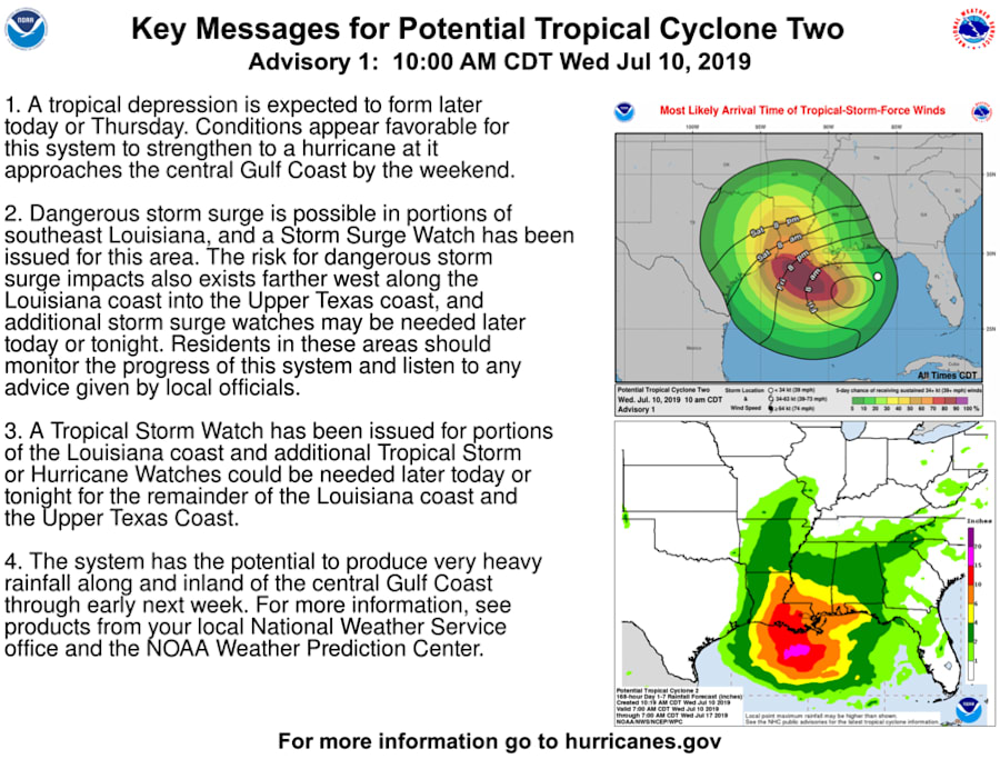
JACKSONVILLE, Fla. – A low-pressure system that moved into the Gulf of Mexico late Tuesday was upgraded this morning to a potential tropical cyclone. If forecasters are correct, it will be a Category 1 hurricane by Saturday.
The National Hurricane Center expects the system, located about 155 miles east southeast of the mouth of the Mississippi River at 2 p.m. Wednesday, to strengthen into a tropical storm by Thursday. It would be named Barry. As of 10:30 a.m. the system had 30 mph sustained winds and was moving west southwest at 8 mph.
Recommended Videos
TRACK THE STORM: Interactive map of the tropics
This disturbance has the potential to produce heavy rainfall from the upper Texas Coast to the Florida Panhandle over the next several days. But most of the flooding potential will be where it comes ashore and east of the final landfall location.
A Storm Surge Watch has been issued from the mouth of the Pearl River to Morgan City, Louisiana. A Tropical Storm Watch has been issued from the mouth of the Mississippi River to Morgan City, Louisiana.
Heavy rains and flooding are already occurring in southeast Louisiana. [Full story]
An Air Force Reserve Unit reconnaissance aircraft is scheduled to investigate the depression Wednesday.
With the system over water, environmental conditions are expected to be conducive for tropical cyclone formation. The five-day NHC forecast calls for this system to be a tropical storm by Thursday afternoon and a Category 1 hurricane by Saturday morning as it nears the western Louisiana coast.
This system has the potential to produce heavy rainfall along portions of the northern and eastern U.S. Gulf Coast later this week. Interests along the Gulf Coast from the Upper Texas coast to the western Florida peninsula should monitor the progress of this system.
As the low drifts south and west, it will drag tropical moisture across our area and enhance our chances for waves of downpours to sweep past on Wednesday, but by Thursday, the moisture will be dragged further west and allow Jacksonville to dry out a little.


