AMELIA ISLAND, Fla. – There were clear skies throughout Northeast Florida Thursday morning, yet a waterspout formed. How?
The waterspout spotted by several people at Fort Clinch State Park about 7:20 a.m. Thursday looked like a scary tornado, yet this fair-weather waterspout is much weaker.
Because they develop differently compared to more powerful supercell tornadoes, waterspouts are generally much weaker, with winds less that 60 mph and typically last about 20 minutes.
PHOTOS: Jaw-dropping waterspout forms near Fernandina Beach
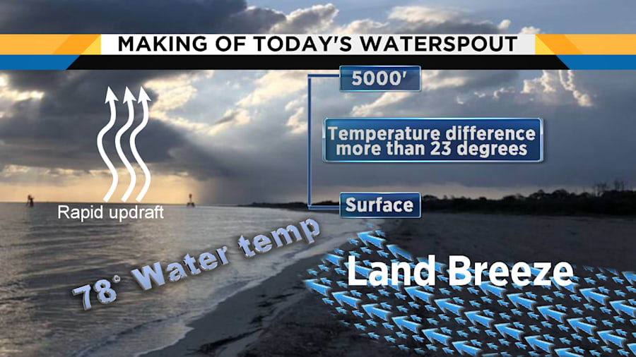
This waterspout formed quickly in a region of clear skies after clouds popped due to a unique set of weather conditions that included unusually cool morning temperatures.
A land breeze of offshore winds flowed from cooler 60-degree land out over the 78-degree Atlantic Ocean water, sparking the formation.
Air rapidly lifts over the warmer water near the shore.
This air convergence leads to cloud development and the accompanying line of stationary showers just offshore.

Due to much cooler air 5,000 feet above, a rising updraft of air stretched quickly, increasing low-level spin, forming a waterspout.
Winds were less than 5 mph around Amelia Island this morning -- a requirement since fair-weather waterspouts are fragile and easily disrupted by too much wind.
If it had made landfall, it would have been renamed a tornado.


