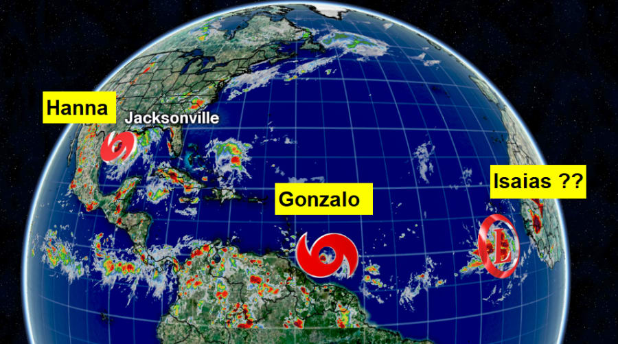
JACKSONVILLE, Fla – Hurricane Hunter aircraft flew over Tropical Storm Hanna on Friday evening and found the storm had strengthened to just below hurricane strength as it moves toward the Texas coastline.
Hanna threatens to bring heavy rain, rough waters and strong winds, all while another tropical storm (Gonzalo) continues to remain weak and approach the Windward Islands.
Recommended Videos

At 5 a.m. Saturday, the center of Tropical Storm Hanna had sustained winds of 70 mph. According to the National Hurricane Center, the center of the storm was about 115 miles east-northeast of Corpus Christi, Taxas. A gradual turn toward the about the time Hanna makes landfall in late afternoon or early evening, taking the weakening storm into Mexico on Sunday.
Forecasters increased the expected rainfall totals in its update, saying that Hanna could bring 6 to 12 inches of rain and coastal swells that “are likely to cause life-threatening surf and rip current conditions,” the advisory stated.
INTERACTIVE: Track the Tropics
Hanna broke the record as the earliest eighth Atlantic named storm, according to Colorado State University hurricane researcher Phil Klotzbach. The previous record was Harvey on Aug. 3, 2005, Klotzbach tweeted.
Far out in the Atlantic, the next system could become Isaias by Monday.
Stay alert and review our hurricane section.


