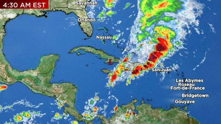
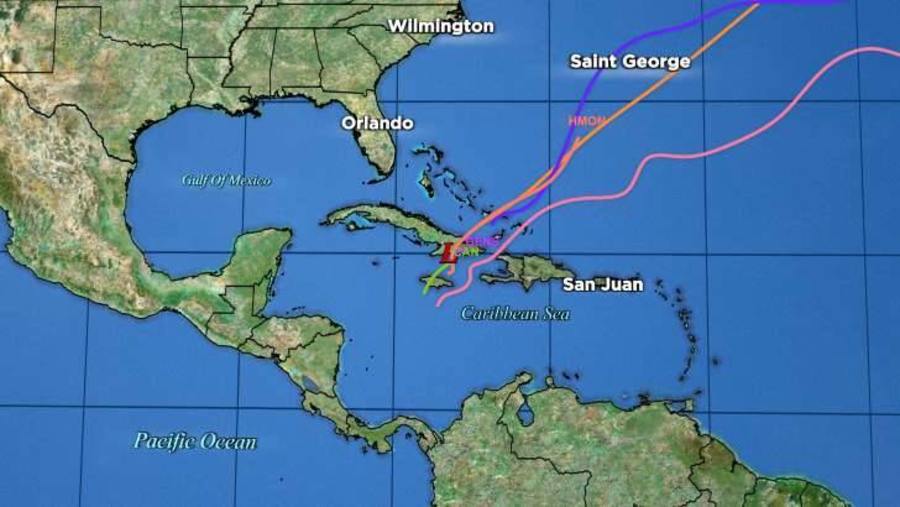
| Location | 140 miles NE of Montego Bay Jamaica |
| Wind | 35 mph |
| Heading | NE at 22 mph |
| Pressure | 29.71 |
| Coordinates | 76.5W, 20.0N |
Recommended Videos
Discussion
At 1000 PM EST (0300 UTC), the disturbance was centered near latitude 20.0 North, longitude 76.5 West. The system is moving toward the northeast near 22 mph (35 km/h), and a faster northeastward motion is expected overnight. On the forecast track, the disturbance is expected to move across southeastern Cuba during the next few hours.
Maximum sustained winds are near 35 mph (55 km/h) with higher gusts. The disturbance appears unlikely to become a tropical cyclone before it merges with a frontal system later this weekend. * Formation chance through 48 hours, low, 10 percent. * Formation chance through 7 days, low, 10 percent.
The estimated minimum central pressure is 1006 mb (29.71 inches).

Watches and Warnings
CHANGES WITH THIS ADVISORY:
The Tropical Storm Watch for Haiti has been discontinued.
SUMMARY OF WATCHES AND WARNINGS IN EFFECT:
There are no coastal watches or warnings in effect.
For storm information specific to your area, please monitor products issued by your national meteorological service.

Land Hazards
Key messages for Potential Tropical Cyclone Twenty-Two can be found in the Tropical Cyclone Discussion under AWIPS header MIATCDAT2 and WMO header WTNT42 KNHC, and on the web at hurricanes.gov/text/MIATCDAT2.shtml
RAINFALL: This disturbance is expected to produce additional total rainfall of 4 to 8 inches with maximum amounts of 14 inches across portions of southeastern Cuba and southern Hispaniola through Sunday. These rains are likely to produce flash flooding, along with mudslides in areas of higher terrain.
The system is expected to produce an additional 2 to 4 inches of rainfall across Jamaica, the southeastern Bahamas, as well as the Turks and Caicos Islands. This rainfall may lead to flash flooding in urban areas.
SURF: Swells generated by the disturbance are expected to affect portions of Jamaica, Haiti, and southeastern Cuba through Saturday. These swells are likely to cause life-threatening surf and rip current conditions. Please consult products from your local weather office.


