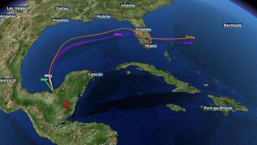
| Location | 90 miles SW of Campeche Mexico |
| Wind | 30 mph |
| Heading | NW at 13 mph |
| Pressure | 29.68 |
| Coordinates | 91.5W, 19.0N |
Recommended Videos
Discussion
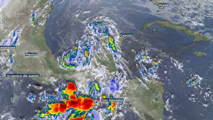
At 300 AM CST (0900 UTC), the remnants of Sara were located near latitude 19.0 North, longitude 91.5 West. The remnants are moving toward the northwest near 13 mph (20 km/h).
Maximum sustained winds are near 30 mph (45 km/h) with higher gusts.
The estimated minimum central pressure is 1005 mb (29.68 inches).

Watches and Warnings
There are no coastal watches or warnings in effect.

Land Hazards
RAINFALL: Additional rainfall amounts of 1 to 3 inches are expected over northern Honduras, with storm total amounts locally as high as 40 inches. The risk of catastrophic and life-threatening flooding impacts will continue, especially along and near the Sierra La Esperanza.
Across portions of Belize, El Salvador, eastern Guatemala, western Nicaragua, and the Mexican State of Quintana Roo, the remnants of Sara are expected to produce an additional 3 to 5 inches of rain with localized storm totals around 15 inches. This will result in areas of flash flooding, perhaps significant, along with the potential of mudslides.
For a complete depiction of forecast rainfall associated with Sara, please see the National Weather Service Storm Total Rainfall Graphic, available at hurricanes.gov/refresh/graphics_at4+shtml/205755.shtml? rainqpf#contents


